Skip to content
Home
News
Seminars
Research
People
Jobs and Scholarships
About
Reports
Contact
Home
News
Seminars
Research
People
Jobs and Scholarships
About
Reports
Contact
Natural Hazards
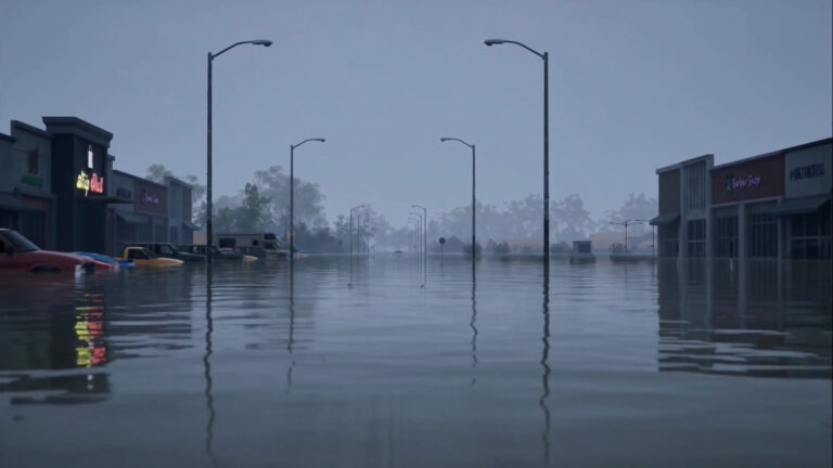
Virtually flooded: Improved risk communication through immersive virtual reality
Read more
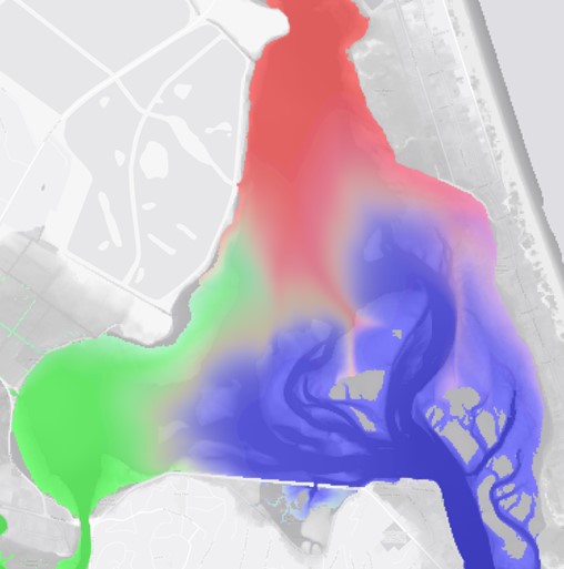
Visualisation of the sources of water contributing to flood inundation
Read more
Implications of uncertainty in flood hazard assessments for planning under climate change
Read more
Building urban development scenarios into assessments of future flood risk
Read more
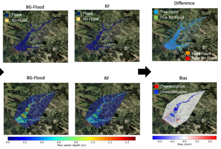
Advancing methods of rapid flood risk assessment using climate informed hybrid approaches of hydraulic modelling and machine learning
Read more
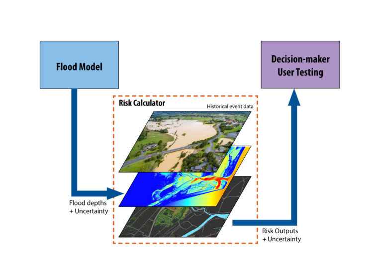
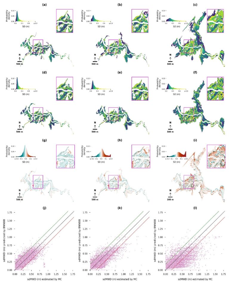
Advancing methods of uncertainty estimation in flood inundation modelling using Monte Carlo and machine learning approaches
Read more
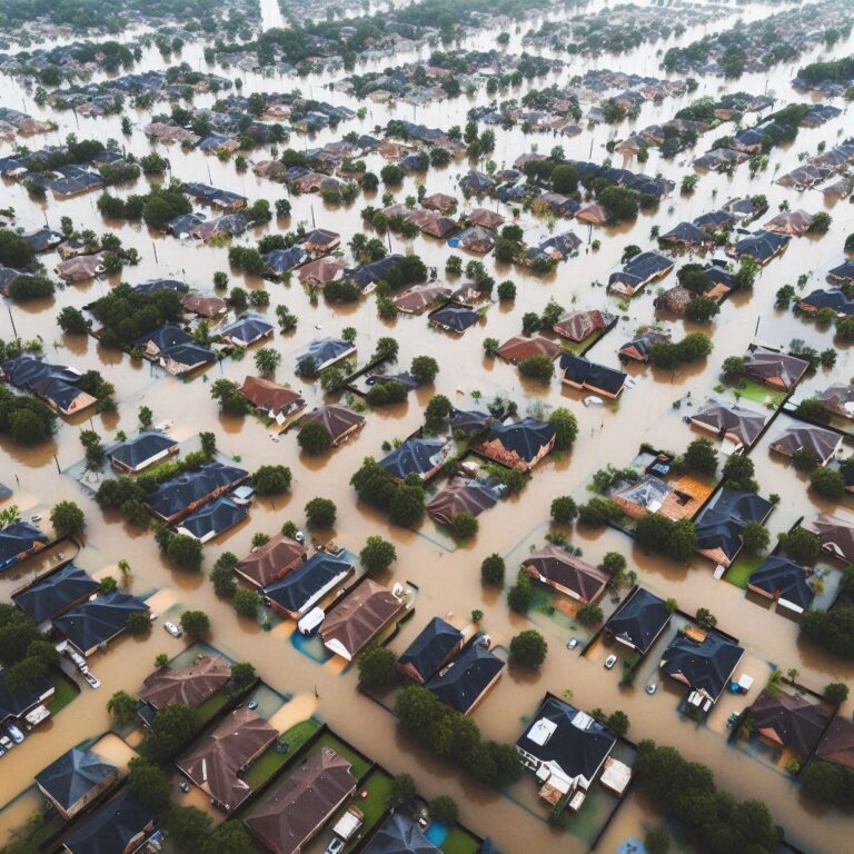
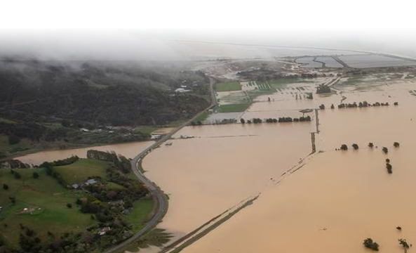
Reducing Flood Inundation Hazard and Risk across Aotearoa New Zealand
Read more
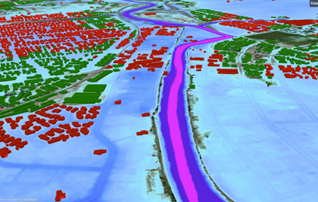
Flood Resilience Digital Twin
Read more
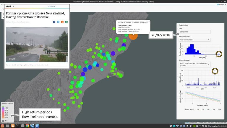
Towards Real-time Federation of Spatial Data for Hazard Risk Management
Read more
Other Research Areas
Health
Co-developed with Māori
Natural Hazards
Remote Sensing
Digital Twins
Urban Development
Water Resources
Machine Learning
Spatial Ecology