Skip to content
Home
News
Seminars
Research
People
Jobs and Scholarships
About
Reports
Contact
Home
News
Seminars
Research
People
Jobs and Scholarships
About
Reports
Contact
Urban Development
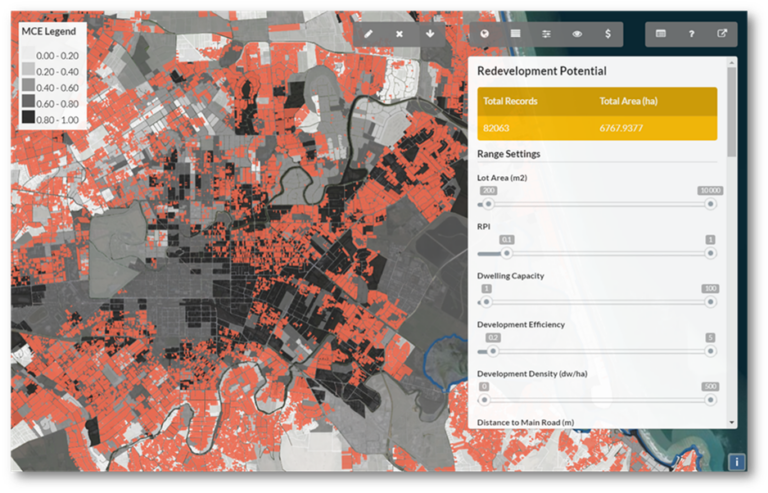
Greening the Greyfields
Read more
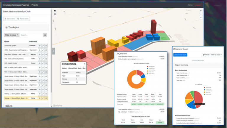
Carbon Neutral Neighbourhoods dashboard development
Read more
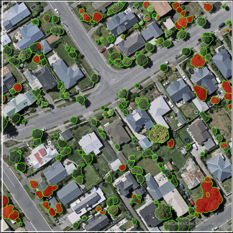
Urban Trees and Housing Intensification: A Spatial Conflict?
Read more
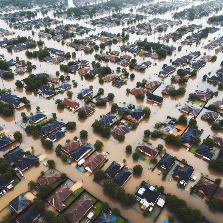
Building urban development scenarios into assessments of future flood risk
Read more
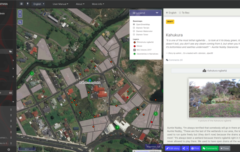
Map-based tools for Community and Rūnanga-led sustainable town planning, in small and medium settlements in New Zealand
Read more
Map-based tools for community and Runanga-led sustainable town planning
Read more
Geospatial data availability, quality, needs
Read more
The Building Better Homes Towns and Cities: Ko ngā wā kāinga hei whakamahorahora
Read more
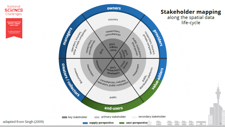
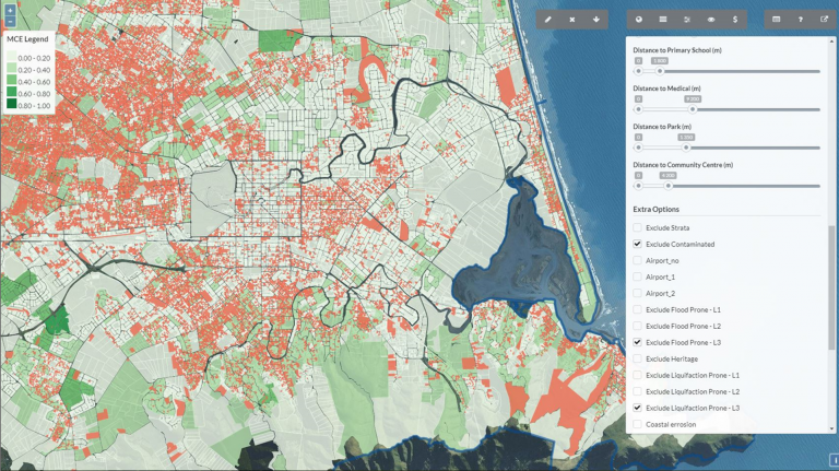
Geospatial tools for better decision-making in urban planning
Read more
Other Research Areas
Health
Co-developed with Māori
Natural Hazards
Remote Sensing
Digital Twins
Urban Development
Water Resources
Machine Learning
Spatial Ecology