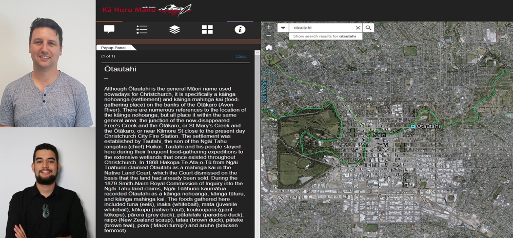
News

Events

Geospatial Research Seminar Series (GRISS) – 29 October 2021 – Recorded

Since 2004 Professor Richard Green has been lecturing in computer science at the University of Canterbury after running his own successful 50 staff software company in Sydney (sold to a multinational). With over 200 refereed publications, Richard heads the Computer Vision Research Lab with an emphasis on autonomous robot vision/deep learning (robots/drones/underwater robots) and analysing human movement.

Read More
Events

Geospatial Research Seminar Series (GRISS) – 24 September 2021 – Recorded

Keri is a passionate Digital Technologist, with a strong background in Geospatial technologies, and over 20 years of international experience in designing enterprise collaboration platforms. Keri is the New Zealand Digital Practice Leader and is focused on identifying digital possibilities and creating opportunities to embed new technologies into our organisational way of working. Keri represents Aurecon on the ANZ Smart Cities Council and on the ANZ Digital Twin Taskforce.

Read More
Events

Geospatial Research Seminar Series (GRISS) – 30 July 2021

In this time of rapid global change, we need new ways to identify, monitor and understand the impact of change on environments and human dynamics such as economy, health and sociopolitical stability. Maxar Earth Intelligence capabilities help customers map, detect, address and predict change at unprecedented speed and scale. Fueled largely by Maxar’s own constellation of high-resolution imaging satellites and combining multi-source data and applied artificial intelligence, machine learning and rich domain knowledge is able to deliver insight as a service.

Read More
Events

Geospatial Research Seminar Series (GRISS) – 25 June 2021

Takiwā is an award winning data management and analytics platform that allows end-users to upload, analyse and present multiple types of data and information within a spatial context in order to solve complex problems. A critical design feature of Takiwā has been the ability to draw together cultural and maatauranga Māori data and information alongside Western scientific data while managing cultural and commercial sensitivities of any datasets. Takiwā CEO Mike Taitoko will introduce the Takiwā platform and illustrate how it can help to empower…

Read More
Projects

Integrated Surveillance

This project aims to develop a Mātauranga Māori Framework for Surveillance (MMFS) of plant pathogens that seeks to enable strategic trust relationships between hapū kaitiaki and rangatira (Maori authorities) directly with central, regional and local organizations that generate and provide science and research initiatives and investment, with particular focus on mātauranga Māori alongside western science.

Read More
Events

Geospatial Research Seminar Series (GRISS) – 28 May 2021

NZ now has a tool that has been developed to identify high risk locations for safety interventions in order to reduce the horrific financial and emotional cost of road fatalities.  The Safer Journeys Risk Assessment Tool or more commonly, ‘MegaMaps’, and has been produced by Waka Kotahi NZ Transport Agency with the assistance of Abley, a national professional services firm. The tool is a significant asset for New Zealand.  This presentation will explain the tool, how it came to exist and why it is unique nationally and globally.

Read More