Prof. Matt Wilson, Director, Geospatial Research Institute (GRI)
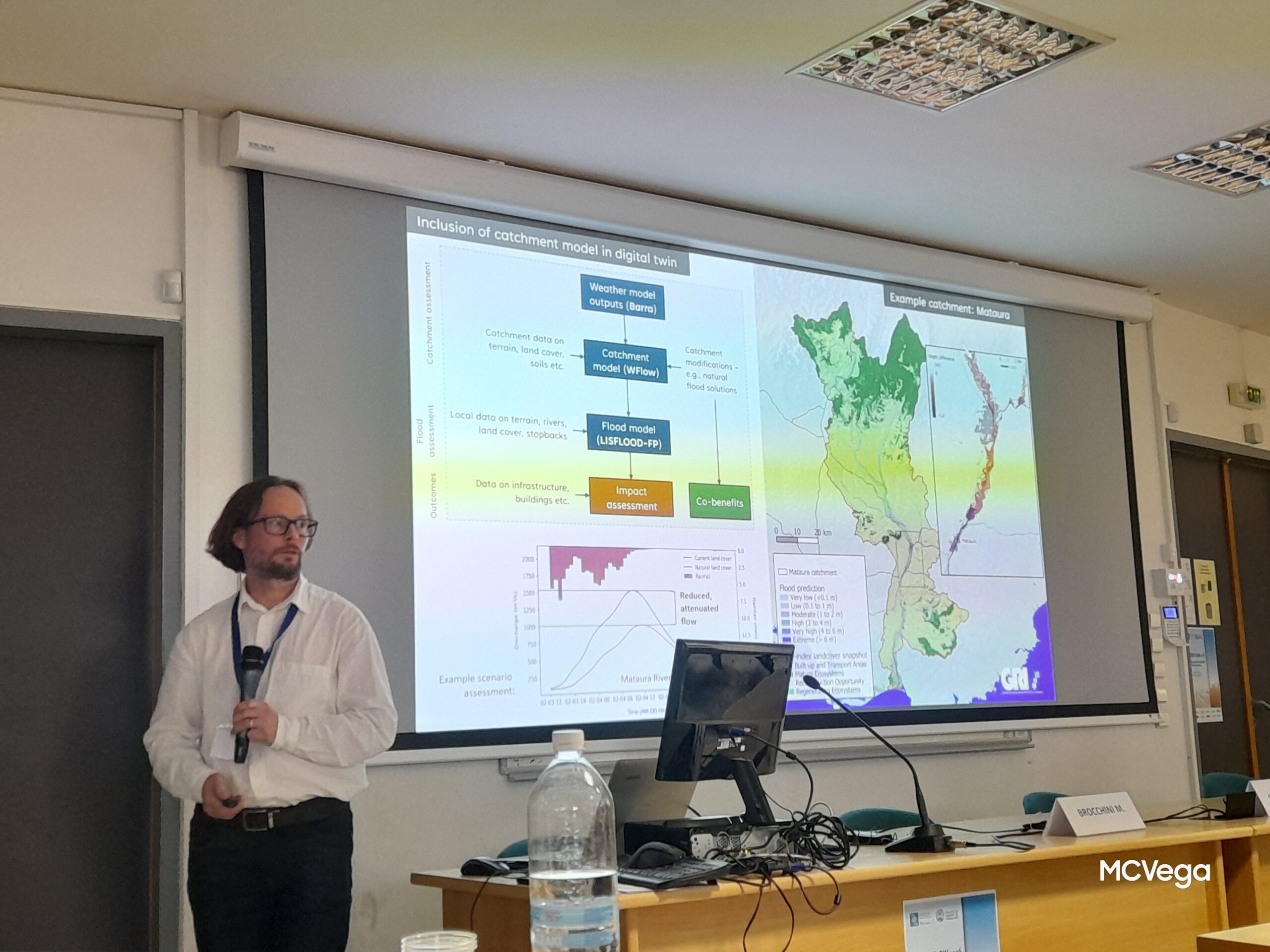
Rob Deakin, Manager, Resilience Group, Land Information New Zealand (LINZ)Dealing with natural hazards, whether planning or response, requires an increasing quantity of disparate spatial data. However, increasing data volumes are difficult to manage, particularly when data are distributed by multiple agencies. Consequently, from the hazard management perspective, data can be difficult to find and differing formats can make it challenging to produce consistent and integrated datasets across regional boundaries. This is particularly the case for nationally-relevant data for a major hazard such as flooding which crosses agency boundaries. To aid with the development of flood risk mitigation, there is a need to increase data interoperability and accessibility, allowing improved mapping and assessment of the flood hazard.
In June 2018 workshop were held to engage with flood risk management practitioners in order to identify current practice and future needs for the development of a data federation system.
The aim of these follow-up sessions is to present workshop findings to attendees, and get any further inputs.
Mon 26 November 2018 12:30 PM – 2:30 PM
LINZ
Level 7, Radio New Zealand House
155 The Terrace Wellington
or
Fri 30 November 2018 2:30 PM – 4:30 PM
Room 101, Undercroft
University of Canterbury
Ilam
Christchurch, Canterbury