Urban Trees and Housing Intensification: A Spatial Conflict?
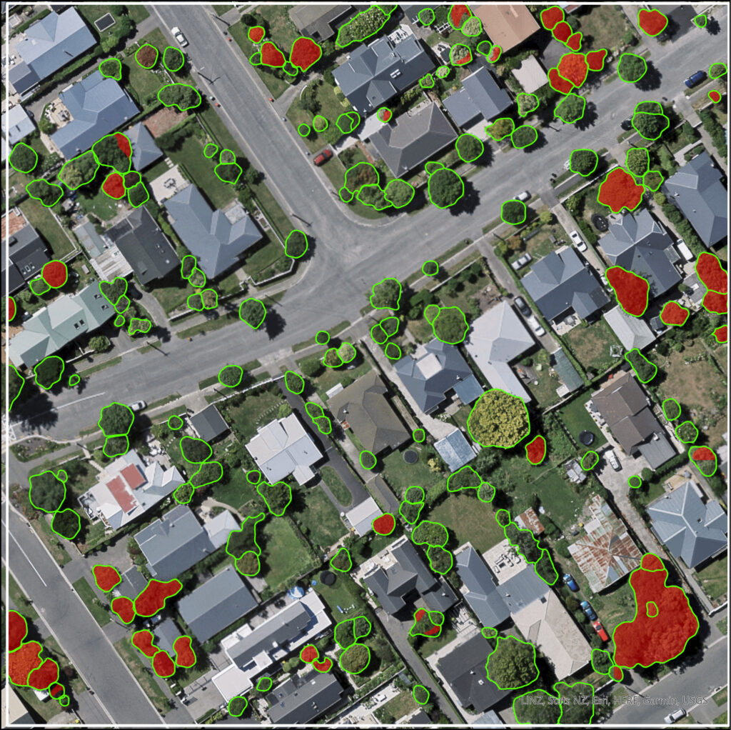
PhD Student David Pedley (SoF- GRI) Supervisors Dr Justin Morgenroth (UoC) Dr Grant Pearse (Flinders University) Funding GRI Scholarship and UC Doctoral Scholarship Project summary Urban trees provide a multitude of environmental and amenity benefits for city occupants yet face ongoing risk of removal due to urban pressures and the preferences of private landowners. Understanding […]
Life-course impact of chronic health conditions: A family and whānau perspective

Research Team: Phoebe Eggleton (PhD Candidate) Malcolm Campbell (Main supervisor – UoC) Matt Hobbs (Secondary supervisor – UoC) Joseph Boden (Supervisor – Christchurch Health and Development Study) Funding UC Aho Hīnātore | UC Accelerator Scholarship Duration 2022-2024 Project summary The Canterbury (NZ) Earthquake Sequence (2010—2011) is made up of four major earthquakes. This project investigates how […]
Breaking through the cloud: Vaping in Aotearoa New Zealand
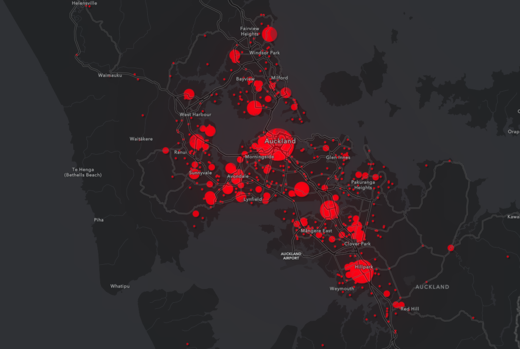
Research TeamIsaac Waterman (GeoHealth Lab intern – UoC)Lukáš Marek (GRI – UoC)Annabel Ahuriri-Driscoll (FoH – UoC)Jalal Mohammed (FoH – UoC)Michael Epton (FoH – UoC)Matt Hobbs (FoH – UoC) Funding:HRC Emerging Researcher Duration of Project2023-2024 Summary:Vaping is a relatively new phenomenon that was initially hailed as a promising alternative to smoking. However, the number of non-smokers who have started vaping is […]
Implications of uncertainty in flood hazard assessments for planning under climate change
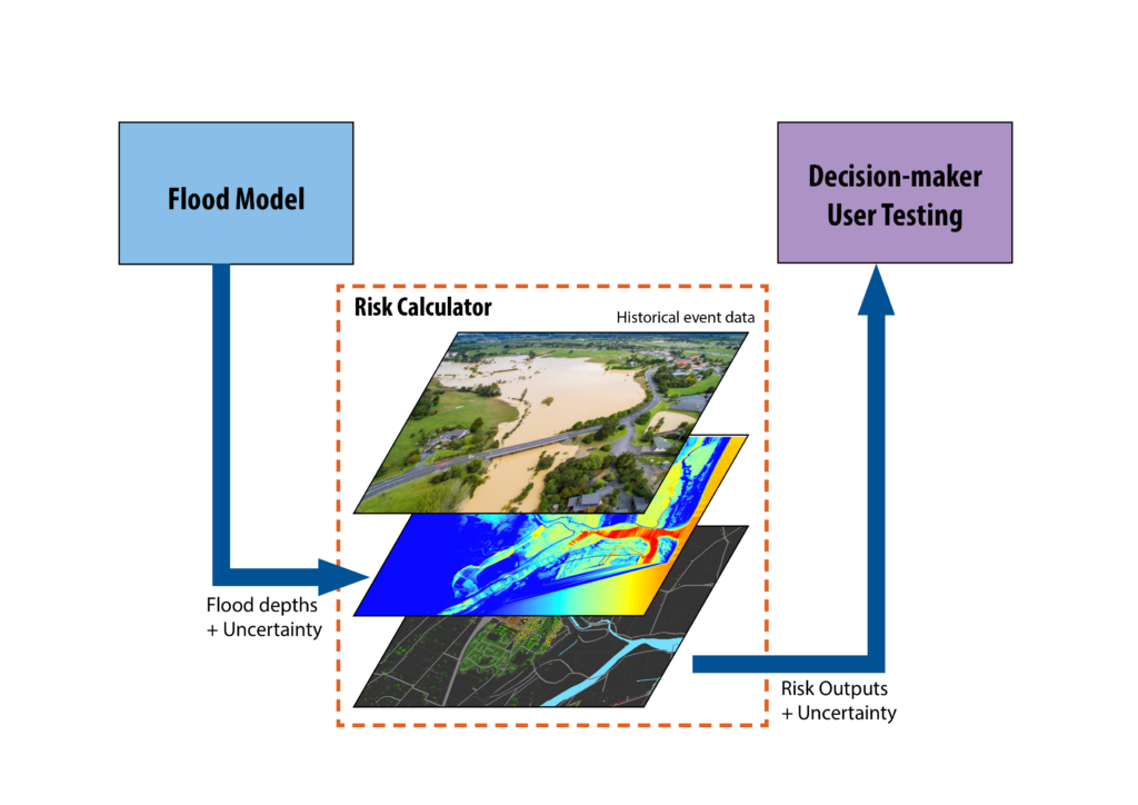
PhD student:Clevon Ash (GRI – UoC) Supervisors:Matthew Wilson (GRI – UoC)Iain White (UoW)Carolynne Hultquist (SEE – UoC) Funding:MBIE Endeavour Research Programme – Increasing flood resilience across Aotearoa, New Zealand. Duration of Project2023-2026 Summary:Like many other countries around the world, New Zealand experienced numerous floods between 2022 and 2023. In 2022, Aotearoa experienced over 600 million […]
Building urban development scenarios into assessments of future flood risk
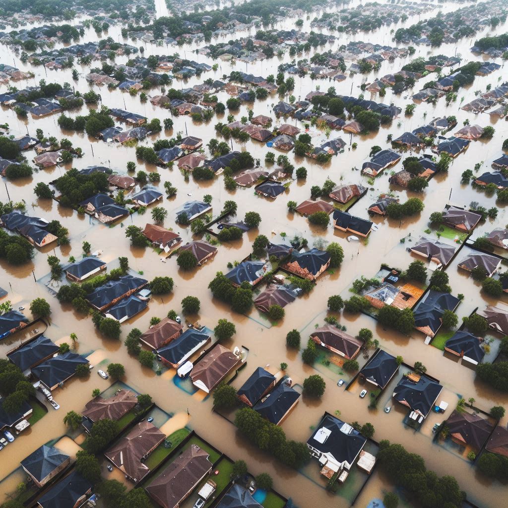
PhD student:Katherine Booker (UoW) Supervisors:Iain White (UoW)Matthew Wilson (GRI – UoC)Xinyu Fu (UoW) Funding:MBIE Endeavour Research Programme – Increasing flood resilience across Aotearoa, New Zealand Duration of ProjectPhD May 2023 – May 2026 (3 years) Summary:The devastating impact of flood events around the globe demonstrates the need for more comprehensive assessments of future flood risk […]
Hybrid hydrodynamic-machine learning model for rapid flood scenario assessment

PhD student:Andrea Pozo Estivariz (PhD student, UoC) Supervisors:Emily Lane (NIWA)Matthew Wilson (UoC)Marwan Katurji (UoC)Fernando Méndez (Universidad de Cantabria) Funding:MBIE Endeavour Research Programme – Increasing flood resilience across Aotearoa, New Zealand. Summary:Flooding is the most frequent natural hazard in New Zealand and the second-most costly after earthquakes. It is also expected to become more severe as […]
Estimating uncertainty in flood model outputs using machine learning informed by Monte Carlo analysis
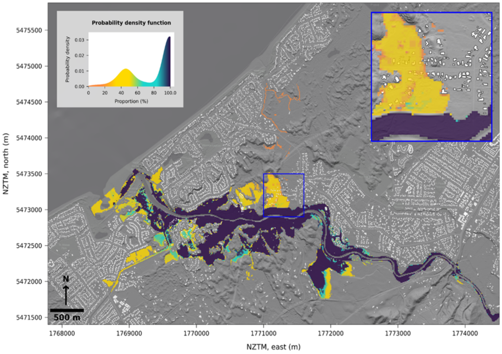
PhD student:Martin Nguyen (PhD student, UoC) Supervisors:Matthew Wilson (Main Supervisor, UoC)Emily Lane (Supervisor, NIWA)James Brasington (UoC)Rose Pearson (NIWA) Funding:MBIE Endeavour Research Programme – Increasing flood resilience across Aotearoa, New Zealand Summary:Topography is an important input for flood inundation model and how to obtain accurate representations of it has not been properly studied. In general, for […]
Monitoring Hate Speech and Offensive Language on Social Media
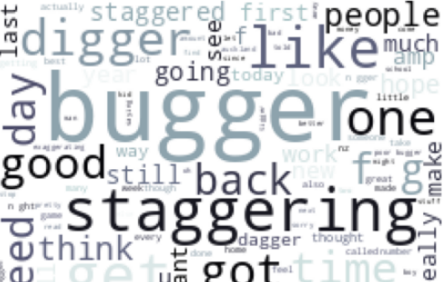
Date September 5-6, 2023 Submitted to The Fourth Spatial Data Science Symposium Author Sidney Gig-Jan Wong Abstract Hate speech and offensive language content on social media platforms has increased in both volume and tone across Aotearoa. The current study aims to develop a method to monitor hate speech and offensive language using transformer-based pretrained language […]
Building Future Urban Development Scenarios into Assessments of Future Flood Risk
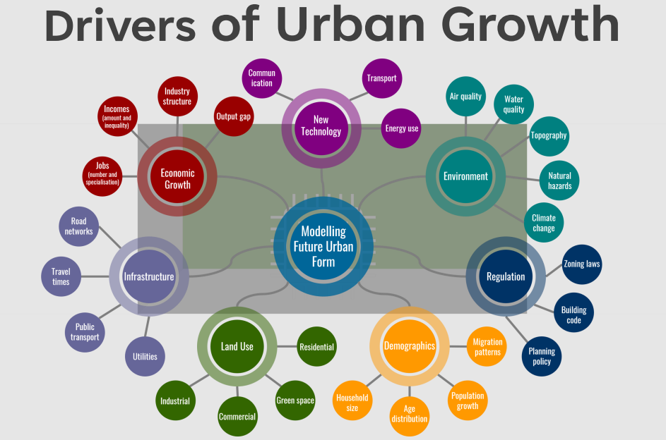
Date September 5-6, 2023 Submitted to The Fourth Spatial Data Science Symposium Author Katherine Booker Supervisors Professor Iain White, University of Waikato and Professor Matthew Wilson, GRI University of Canterbury Research Problem The devastating impact of flood events demonstrates the need for more comprehensive assessments of future flood risk in urban policy. Risk assessments based […]
Unravelling the Biosecurity Implications of International Tourism in New Zealand
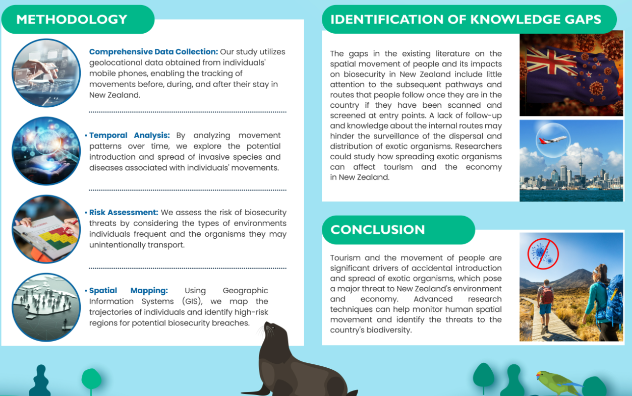
Date September 5-6, 2023 Submitted to The Fourth Spatial Data Science Symposium Authors Ishwarya Anand, Vanessa Bastos, Steve Pawson, Andrew Robinson, Heyang (Thomas) Li Abstract New Zealand is a treasure of biodiversity in the heart of Pacific. Tourism is one of the main causes of the accidental introduction and spread of harmful foreign plants and […]
