
URBAN TREES AND HOUSING INTENSIFICATION: A SPATIAL CONFLICT?

Date September 5-6, 2023 Submitted to The Fourth Spatial Data Science Symposium Author David Pedley Supervisors Dr Justin Morgenroth (UC) and Dr Grant Pearse (Scion) Abstract Urban trees provide a multitude of environmental and amenity benefits for city occupants. In recognition of these benefits, many cities have developed strategies and plans seeking to protect and […]
Use of Felt Rapid Reports as a reliable data source in the production of Earthquake Intensity Maps
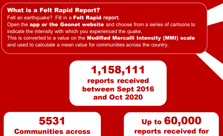
Date September 5-6, 2023 Submitted to The Fourth Spatial Data Science Symposium Author Hazel Fraser Abstract Crowdsourcing has the potential for use in a wide range of hazard applications by timely collection of large quantities of data. One example is GeoNet’s Felt Rapid Report (FRR) data which has received up to 61,000 reports within 15 […]
Analysis of New Zealand daily weather patterns (DWTs) and large-scale climatic patterns as extreme rainfall and flooding drivers
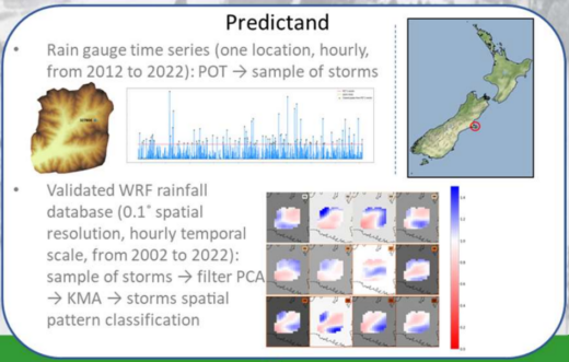
Research team Andrea Pozo, Matthew Wilson, Marwan Katurji, Fernando Méndez, Emily Lane Summary The overall aim of this research project is the generation of flood inundation maps for a specific study site, namely the Wairewa catchment (Little River, Canterbury) for the benefit of community stakeholders. To this end, accurate analysis and characterization of extreme rainfall […]
Advancing efficiencies in remote sensing of Ross Sea Adélie penguin populations
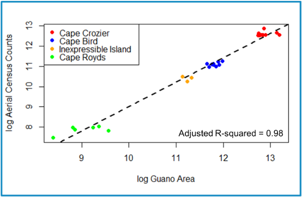
Research Team Alexandra Strang, Dean Anderson, Esme Robinson, Grant Ballard, Annie Schmidt, David Ainley, Kerry Barton, Fiona Shanhun, Rebecca Macneil, Elissa Cameron, Michelle LaRue Project Aim Identify an objective method to assess guano area characteristics over the 2009-2021 austral summers for four colonies, to improve this tool toward better assessment of population changes. Click […]