Research team
Andrea Pozo, Matthew Wilson, Marwan Katurji, Fernando Méndez, Emily Lane
Summary
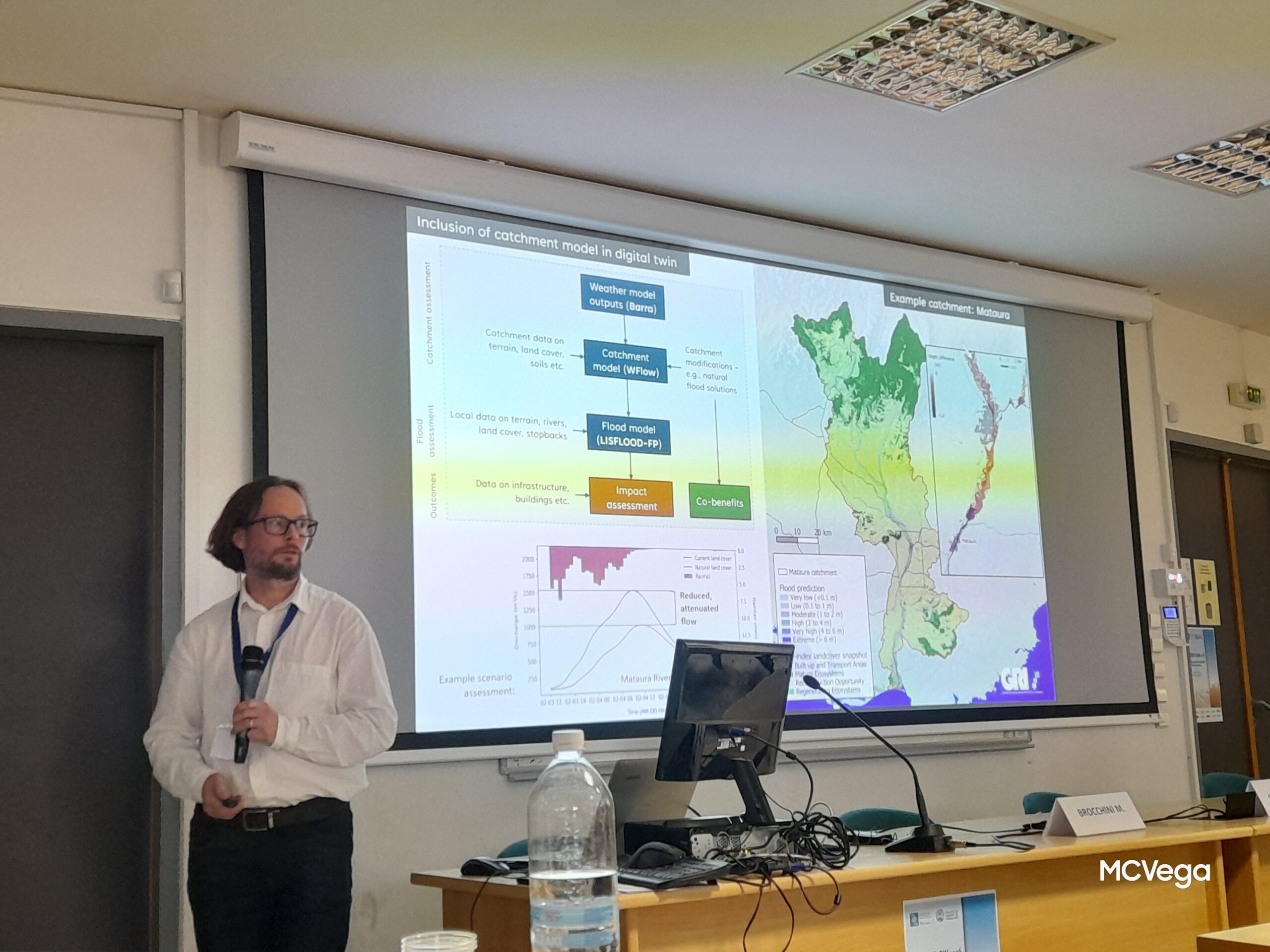
The overall aim of this research project is the generation of flood inundation maps for a specific study site, namely the Wairewa catchment (Little River, Canterbury) for the benefit of community stakeholders. To this end, accurate analysis and characterization of extreme rainfall is required since this is the main inundation driver. This work aims to study extreme rainfall events that can potentially lead to flooding using synoptic climatological techniques. It builds on previous work in the field (Jiang 2011; Kidson 1997, 2000) and proposes a new weather type classification is based on ERA5 reanalysis daily fields of mean sea level pressure (MLSP) and 500 hPa geopotential height. The relationship between the DWTs, heavy rainfall and historical flooding events is investigated in the study site; as well as the influence of three large-scale climatic patterns: El Niño Southern Oscillation (ENSO) the Southern Annular Mode (SAM) and the Indian Ocean Dipole (IOD).
Download the Poster PDF