
Virtually flooded: Improved risk communication through immersive virtual reality
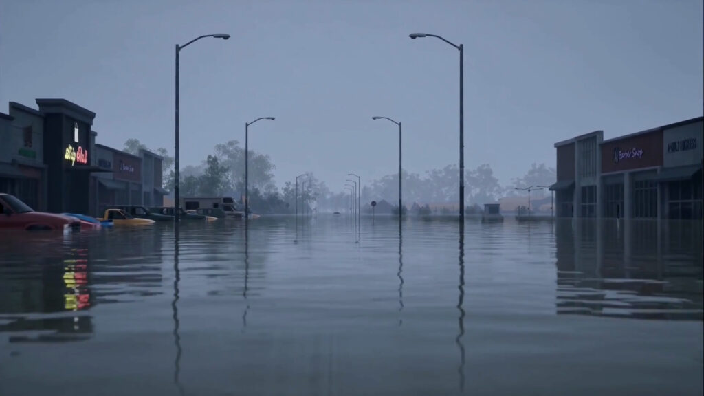
Research team Matthew Wilson (University of Canterbury) Iain Gover (Te Rūnanga o Ngāi Tahu) Xander Cai (University of Canterbury) Luke Parkinson (University of Canterbury) Funding The Natural Hazards Commission Project summary Flood inundation is a frequent, widespread, and impactful hazard, which regularly causes damage to housing and infrastructure along with disruption to whanau, communities, and […]
Visualisation of the sources of water contributing to flood inundation
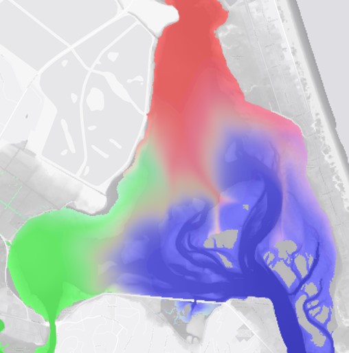
Research team Matthew Wilson (GRI) and Tom Coulthard (University of Hull, UK) Duration 2019-2020 Project summary Computational models of flood inundation are often used for determining areas which may be impacted by a flood event of a particular level, and are invaluable tools for increasing our understanding of flood dynamics and risk. They work on […]
Implications of uncertainty in flood hazard assessments for planning under climate change
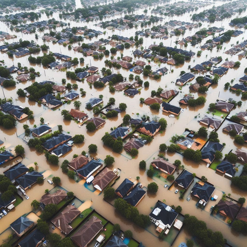
PhD student:Clevon Ash (GRI – UoC) Supervisors:Matthew Wilson (GRI – UoC)Iain White (UoW)Carolynne Hultquist (SEE – UoC) Funding:MBIE Endeavour Research Programme – Increasing flood resilience across Aotearoa, New Zealand. Duration of Project2023-2026 Summary:Like many other countries around the world, New Zealand experienced numerous floods between 2022 and 2023. In 2022 Aotearoa experienced over 600 million […]
Building urban development scenarios into assessments of future flood risk
PhD student:Katherine Booker (UoW) Supervisors:Iain White (UoW)Matthew Wilson (GRI – UoC)Xinyu Fu (UoW) Funding:MBIE Endeavour Research Programme – Increasing flood resilience across Aotearoa, New Zealand Duration of Project2023 – 2026 Summary:Flooding is one of the costliest natural hazards in Aotearoa-New Zealand, and with a warming climate is expected to become more frequent and more severe […]
Advancing methods of rapid flood risk assessment using climate informed hybrid approaches of hydraulic modelling and machine learning
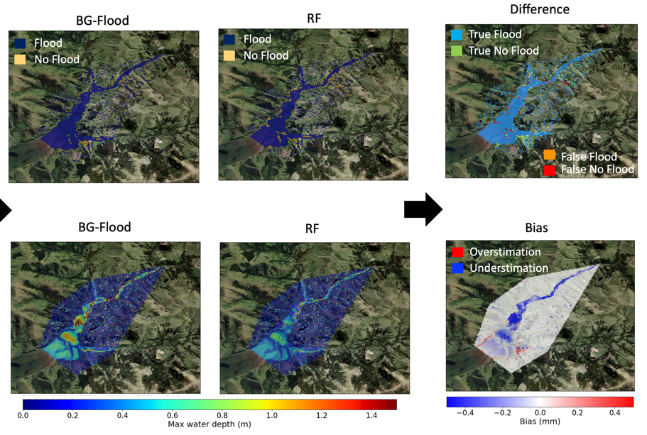
PhD student:Andrea Pozo Estivariz (PhD student, UoC) Supervisors:Matthew Wilson (UoC)Emily Lane (Earth Sciences NZ)Marwan Katurji (UoC)Fernando Méndez (Universidad de Cantabria)Cyprien Bosserelle (Earth Sciences NZ) Funding:MBIE Endeavour Research Programme – Increasing flood resilience across Aotearoa, New Zealand. Duration:2021 – 2025 Summary:Flooding is among the most devastating natural hazards affecting communities, infrastructure, economies and ecosystems. As climate […]
Advancing methods of uncertainty estimation in flood inundation modelling using Monte Carlo and machine learning approaches
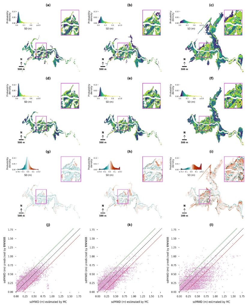
PhD student:Martin Nguyen (PhD student, UoC) Supervisors:Matthew Wilson (Main Supervisor, UoC)Emily Lane (Supervisor, Earth Sciences NZ)James Brasington (UoC)Rose Pearson (Earth Sciences NZ) Funding:MBIE Endeavour Research Programme – Increasing flood resilience across Aotearoa, New Zealand Summary:Uncertainties inherent in the flood modelling process, especially in the input data, can affect flood predictions, reducing reliability of flood risk […]
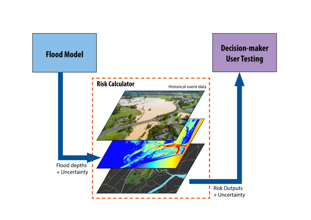
Reducing Flood Inundation Hazard and Risk across Aotearoa New Zealand
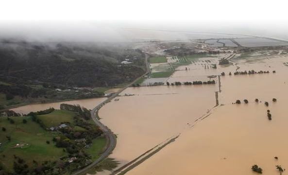
Project lead: Dr. Emily Lane (NIWA) GRI Team: Prof. Matthew Wilson (Uncertainty Lead) Dr Rose Pearson (NIWA/GRI visiting research fellow) Martin Nguyen (UoC PhD student) Andrea Pozo Estivariz (UoC PhD student) Katherine Booker (UoW PhD student) Clevon Ash (UoC PhD student) Funding: MBIE Endeavour Research Programme – Increasing flood resilience across Aotearoa, New Zealand. Summary: […]
Flood Resilience Digital Twin
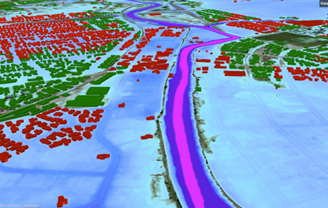
Project Team GRI Luke Parkinson (Software developer) Casey Li (Software developer) Pooja Kholsa (Software developer) Matt Wilson (PI) Wider Team Greg Preston (BIP) Rose Pearson Cyprien Bosserelle (NIWA) Emily Lane (NIWA) Rob Deakin (LINZ) Project summary This project aims to create a “digital twin” prototype as a proof-of-concept system to assist with more efficient flood […]
Towards Real-time Federation of Spatial Data for Hazard Risk Management
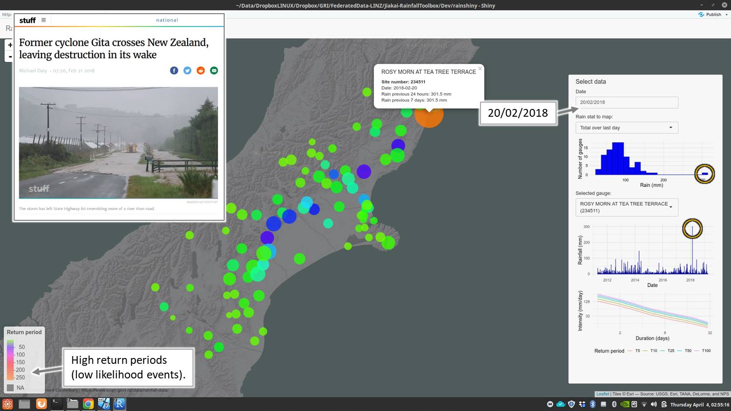
Project leaders Matthew Wilson (GRI) Robert Deakin (LINZ) David McMeekin (Curtin University) Project team Jeremy Siao Him Fa (Curtin) Kasey Oomen (LINZ) Ivana Ivánová (Curtin) Duration 2017 Funding CRCSI and LINZ Aim In this project, we aimed to address these issues through the specification of federated spatial data infrastructures which may then form a key […]