
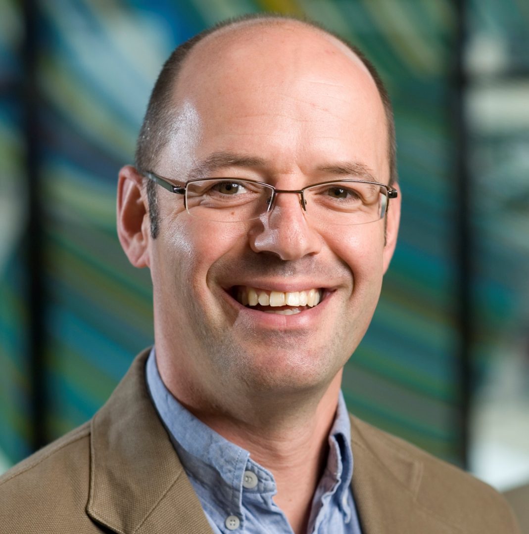
Award for researcher’s efforts to help NZers stay healthy
Wanting people to live healthier and happier lives is a big motivation for public health researcher Dr Matt Hobbs, who has been recognised for outstanding work in his field. Dr Matt Hobbs, a Senior Lecturer in Public Health in the University of Canterbury (UC) Faculty of Health, has won a UC Early and Emerging […]
Te Kete Kōrero o Ōhinemutu; Geospatial tool for community & Māori-led planning
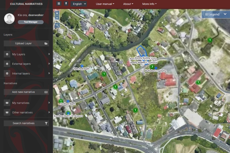
Te Kete Kōrero o Ōhinemutu is a Mātauranga Māori map-based tool co-created by the community of Ōhinemutu and the Geospatial Research Institute Toi Hangarau. Ōhinemutu is a village with deep connection to Ngāti Whakaue. Built on the shores of Lake Rotorua, it is famed for its geothermal features and Te Papa-i-Ouru marae. Te Kete Kōrero o Ōhinemutu has been built to hold and share historical narratives of Ōhinemutu as well as current community initiatives. The range of narratives includes traditional, historic, scientific and lived experiences.
Geospatial Research Seminar Series (GRISS) – 5 March 2021
Global Satellite Navigations Systems such as GPS enable positioning information accurate to about 5-10 metres. A Satellite Based Augmentation System (SBAS) will improve the accuracy to less than a metre, and in some devices to 10 centimetres, and provide greater integrity. More precise and accurate positioning increases our productivity, secures our safety and enables innovation. Unlike most regions of the developed world where SBAS is available, Australasia does not currently have access to any reliable free-to-air augmentation services. LINZ and Geoscience Australia are working together to develop a regional SBAS to improve the accuracy of GPS.
Geospatial Research Seminar Series (GRISS) – 27 November 2020
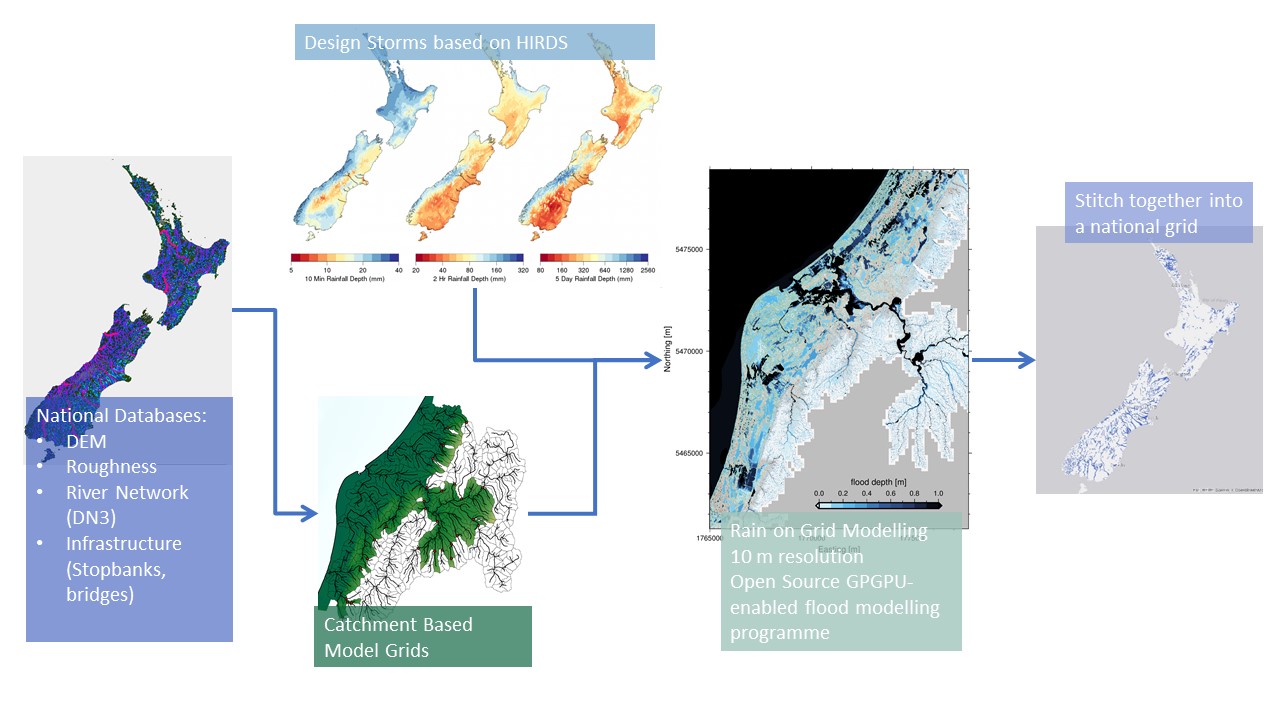
Flooding is Aotearoa/New Zealand’s most frequent hazard and its impact will only increase under climate change through both more intense rainfall events and sea level rise. We are currently going through a massive flooding infrastructure revamp as well as investing in significant urban development. However, we don’t yet have a consistent national understanding of what our flood risk is now – let alone in the future.
Geospatial Research Seminar Series (GRISS) – 25 September 2020 (online & in person)
Prof Sabel is a spatial data scientist working in the nexus between health and spatial data informatics. He is Director, BERTHA – Big Data Centre for Environment and Health at Aarhus University, but previously worked at the University of Canterbury, Department of Geography as a GISc lecturer. The BERTHA Big Data Centre for Environment and Health at Aarhus University, Denmark, aims to muster the huge potential opportunities from the Big Data revolution to help us understand the complex interactions between environmental pollutants and human health.
Professor Wendy Lawson as winner of their Outstanding Contribution to Spatial Award for 2019
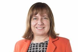
The New Zealand Spatial Excellence Awards (NZSEA) have named Assistant Vice-Chancellor Strategic Projects Professor Wendy Lawson as winner of their Outstanding Contribution to Spatial Award for 2019. The Outstanding Contribution to Spatial Award recognises an individual who has contributed significantly to the spatial sector throughout their career, including furthering the reach of the sector, driving […]
GEOSPATIAL RESEARCH SEMINAR SERIES (GRISS) – 25 October 2019
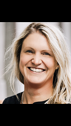
The Geospatial Research Institute is pleased to host Dr Kat Salm. Kat has been working in the spatial industry in New Zealand across government, industry, and research/education for a number of years. She is also the winner of the 2018 New Zealand Spatial Excellence Awards (NZSEA) in the category “Women’s Leadership Award”, as well as the 2019 Asia-Pacific Spatial Excellence Awards (APSEA).
GEOSPATIAL RESEARCH SEMINAR SERIES (GRISS) – 27 September 2019
Regional Councils collect a lot of environmental data. We’re good at it and it is hugely valuable to our policy decisions and general environmental management. A recent valuation of the Environment Canterbury hydrological database was $4.2 billion, based on a mixture of the collection costs and the value of decisions made with those data. With all that data comes the challenge of data management and more importantly; how to tell a coherent story of “what’s going on”. This seminar will set out the types of data collected by Environment Canterbury and discuss possibilities for telling environmental stories in a better way.
GEOSPATIAL RESEARCH SEMINAR SERIES (GRISS) – 26 July 2019
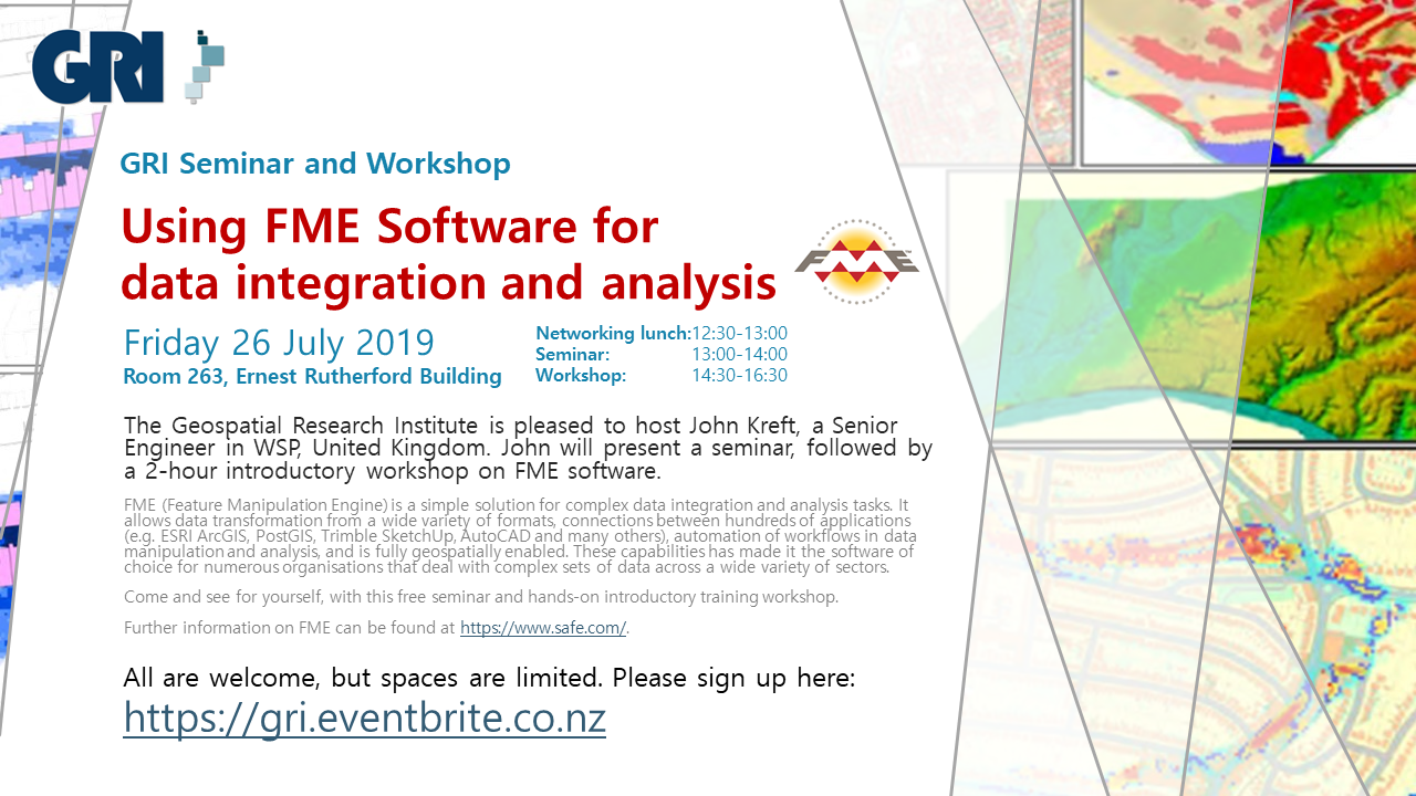
FME (Feature Manipulation Engine) is a simple solution for complex data integration and analysis tasks. It allows data transformation from a wide variety of formats, connections between hundreds of applications (e.g. ESRI ArcGIS, PostGIS, Trimble SketchUp, AutoCAD and many others), automation of workflows in data manipulation and analysis, and is fully geospatially enabled. These capabilities has made it the software of choice for numerous organisations that deal with complex sets of data across a wide variety of sectors.
GeoHealth Lab Seminar, 25 May 2019: A multidisciplinary perspective on environmental determinants of lifestyle and health
Please come along to see Dr. Joreintje Mackenbach-van Es from the Amsterdam UMC present her seminar on the environmental determinants of lifestyle and health. Abstract There is widespread consensus that our environment affects our behaviour and health, but less understanding of how this works. I will mainly focus on food and physical activity environments, but […]