Speakers:
Dr Dean Walker and Luke Parkinson
Dr Dean Walker, Postdoctoral Fellow, Geospatial Research Institute
Luke Parkinson, Geospatial Software Developer, Geospatial Research Institute
Seminar Summary:
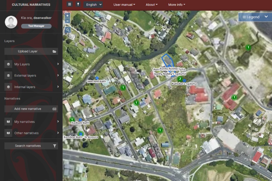
Te Kete Kōrero o Ōhinemutu is a Mātauranga Māori map-based tool co-created by the community of Ōhinemutu and the Geospatial Research Institute Toi Hangarau. Ōhinemutu is a village with deep connection to Ngāti Whakaue. Built on the shores of Lake Rotorua, it is famed for its geothermal features and Te Papa-i-Ouru marae. Te Kete Kōrero o Ōhinemutu has been built to hold and share historical narratives of Ōhinemutu as well as current community initiatives. The range of narratives includes traditional, historic, scientific and lived experiences. Current and potential uses of the tool include community planning, environmental management and the general sharing of narratives of Ōhinemutu whilst at the same time holding and protecting mātauranga through protected levels of access. The tool will help the people of Ōhinemutu inform and be informed about important initiatives in their community
University of Canterbury / Geospatial researchers involved in the project include Dr Rita Dionisio, Dr Dean Walker, Luke Parkinson, Inês Falcão and Dr Sharmilla Savarimuthu working alongside members of Te Manatōpu Hau Kainga o Ōhinemutu
The research was kindly funded by the Ministry of Business, Innovation and Employment through the Endeavour Fund.
Friday 30 Sept 2022
Rehua 329 | University of Canterbury or Online via Zoom
- Refreshments & Networking: 12:30-13:00
- Seminar: 13:00-14:00
Nau mai haere mai!
All are welcome!
Seminar’s video recording: