Skip to content
Home
News
Seminars
Research
People
Jobs and Scholarships
About
Reports
Contact
Home
News
Seminars
Research
People
Jobs and Scholarships
About
Reports
Contact
Research Areas
Co-Developed with Māori
Digital Twins
Health
Machine Learning
Natural Hazards
Remote Sensing
Spatial Ecology
Student Projects
Urban Development
Water Resources
All
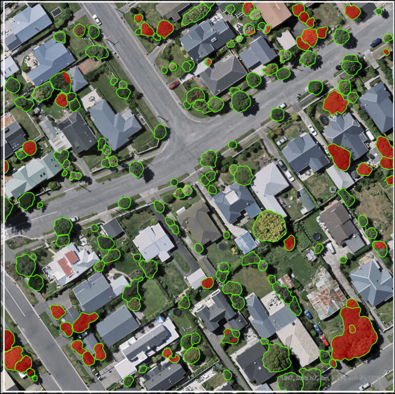
Urban Trees and Housing Intensification: A Spatial Conflict?
Read more
An investigation into how exposure to the Canterbury Earthquake Sequence (2010-11) is associated with physical health: a spatio-temporal birth-cohort study
Read more
Breaking through the cloud: Vaping in Aotearoa New Zealand
Read more
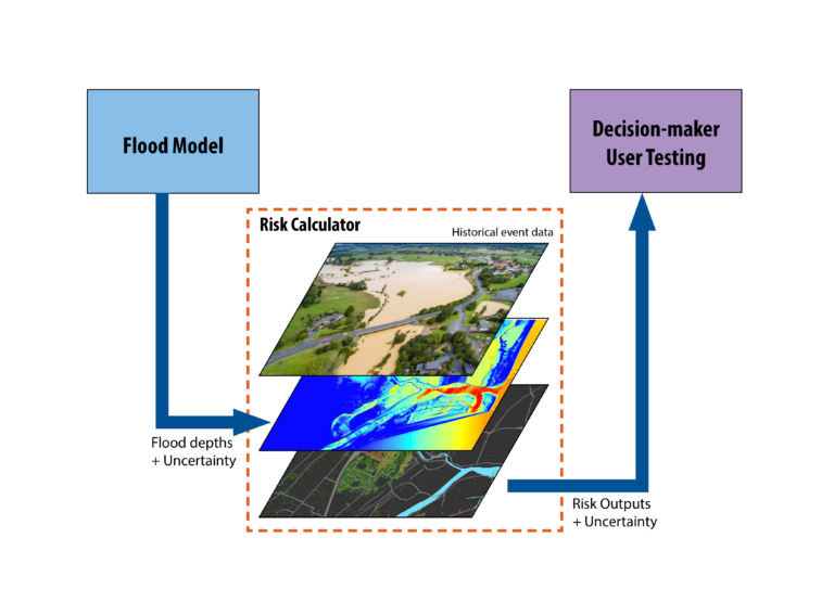
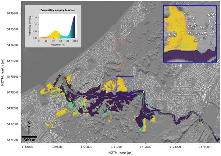
Implications of uncertainty in flood hazard assessments for planning under climate change
Read more
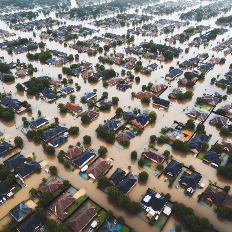
Building urban development scenarios into assessments of future flood risk
Read more
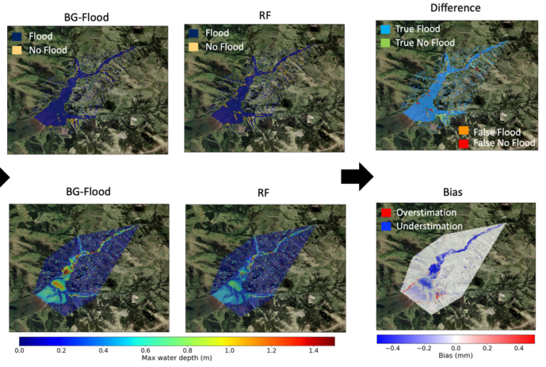
Hybrid hydrodynamic-machine learning model for rapid flood scenario assessment
Read more
Estimating uncertainty in flood model outputs using machine learning informed by Monte Carlo analysis
Read more
Monitoring Hate Speech and Offensive Language on Social Media
Read more
Building Future Urban Development Scenarios into Assessments of Future Flood Risk
Read more
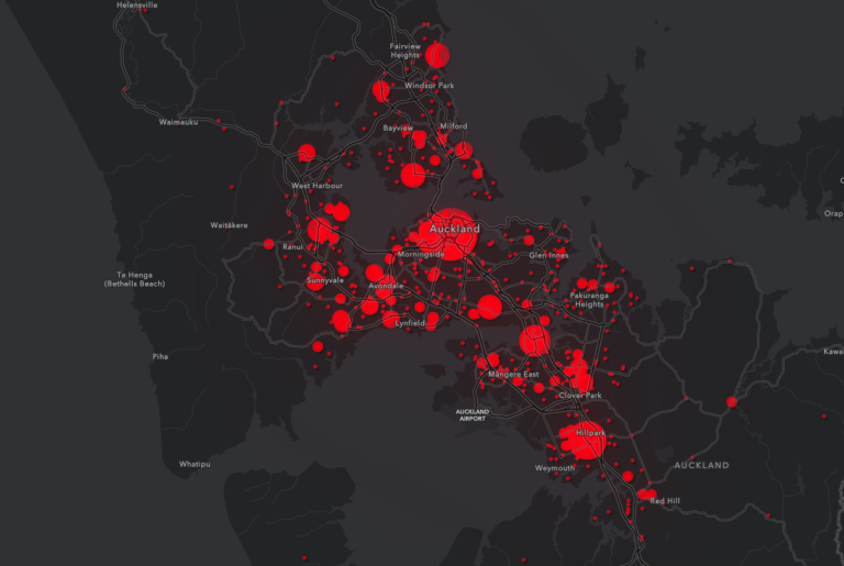
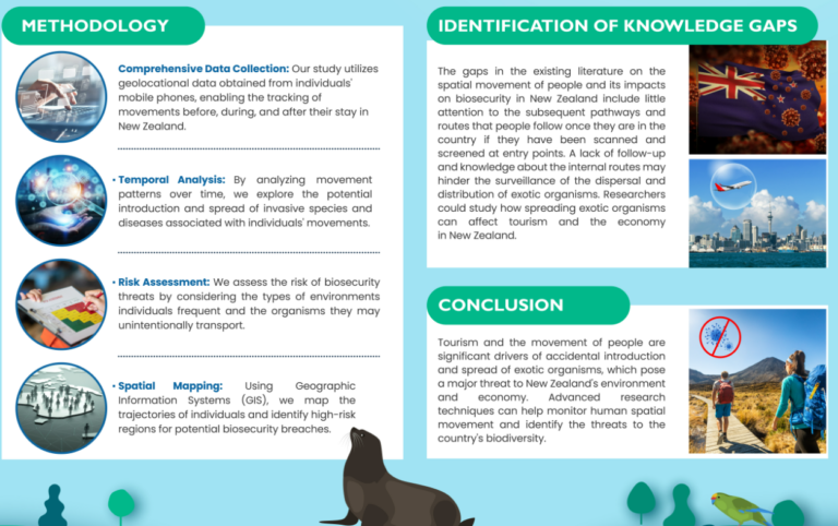
Unravelling the Biosecurity Implications of International Tourism in New Zealand
Read more
URBAN TREES AND HOUSING INTENSIFICATION: A SPATIAL CONFLICT?
Read more
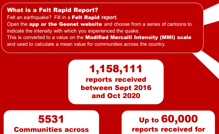
Use of Felt Rapid Reports as a reliable data source in the production of Earthquake Intensity Maps
Read more
Previous
Page
1
Page
2
Next