Skip to content
Home
News
Seminars
Research
People
Jobs and Scholarships
About
Reports
Contact
Home
News
Seminars
Research
People
Jobs and Scholarships
About
Reports
Contact
Research Areas
Co-Developed with Māori
Digital Twins
Health
Machine Learning
Natural Hazards
Remote Sensing
Spatial Ecology
Student Projects
Urban Development
Water Resources
All
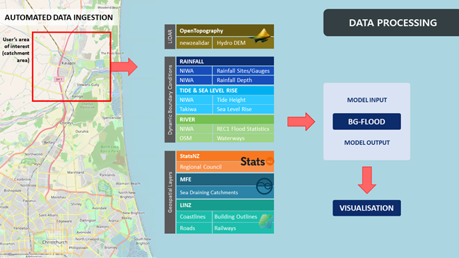
Data processing for the Flood Resilience Digital Twin
Read more
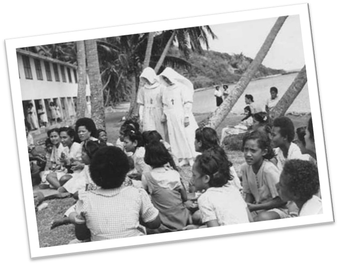
Visualising the Migration of Leprosy Patients Admitted and Discharged from Makogai, Fiji During the 20th Century
Read more
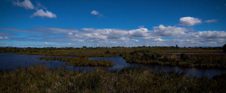
Empowering communities for resilience to climate change through novel flood scenario analytics
Read more
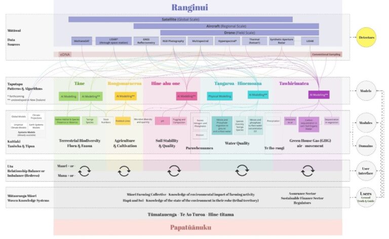
Positioning Māori as first movers in next-generation environmental intelligence: The Kaitiaki Intelligence Platforms (KIPs)
Read more
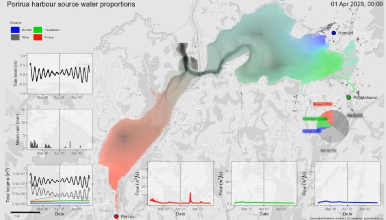
Te Awarua-o-Porirua Harbour flow model: Phase 1
Read more
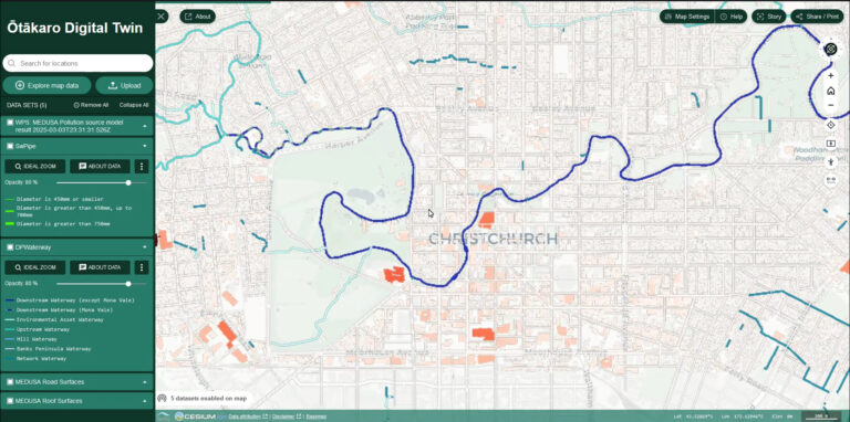
Ōtākaro Digital Twin
Read more
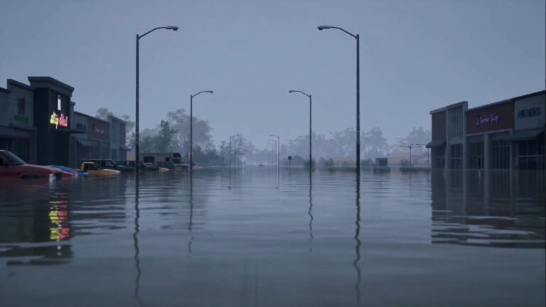
Virtually flooded: Improved risk communication through immersive virtual reality
Read more
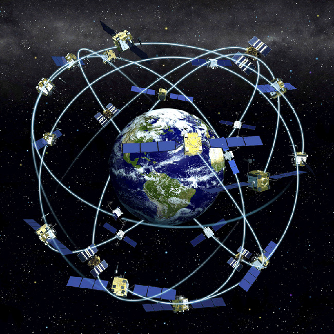
Satellite sensing into agricultural practices: Phase A – ANZ’s Cal/Val campaigns of satellite, airborne and ground GNSS sensing of soil moisture
Read more
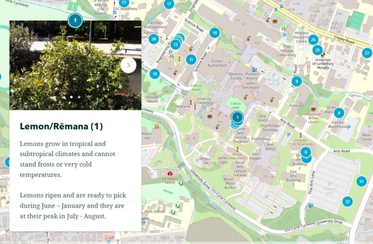
Edible Campus: Food foraging at the University of Canterbury
Read more
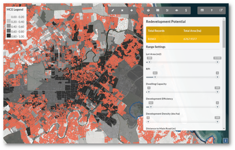
Greening the Greyfields
Read more
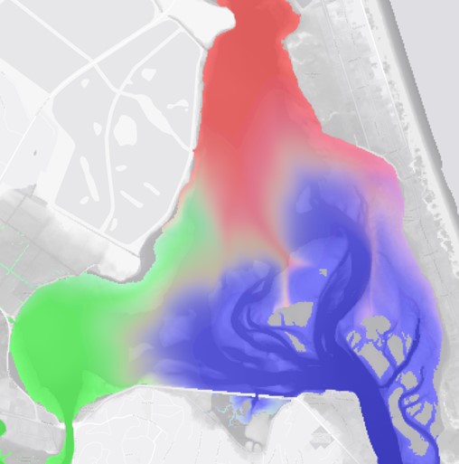
Visualisation of the sources of water contributing to flood inundation
Read more
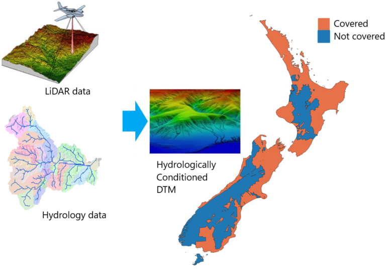
Hydrologically conditioned digital terrain models based on LiDAR for New Zealand
Read more
Previous
Page
1
Page
2
Page
3
…
Page
6
Next