
Date
September 5-6, 2023
Submitted to
The Fourth Spatial Data Science Symposium
Author
Katherine Booker
Supervisor
Phil Davies
Sponsors
Suzanne Gabites and Ilja van Nieuwpoort
Project Aim
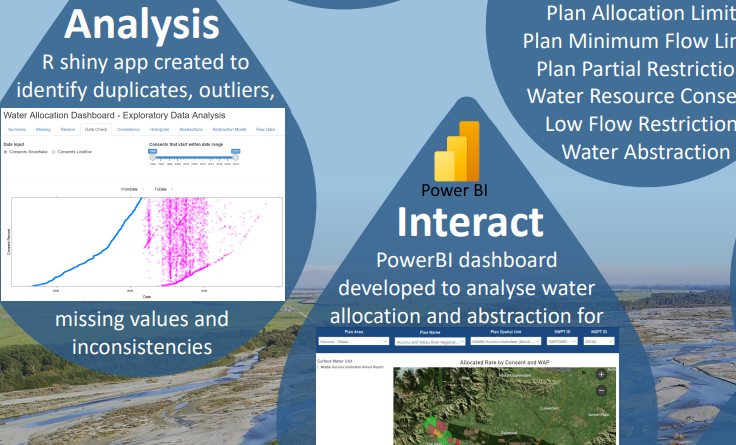
The Land and Water Regional Plan sets limits on the quantity of fresh water in each river or stream that can be allocated to consents to take water, the minimum flow at which water take must cease, and restrictions on water take at variable flows. Are current consent conditions in line with these limits?
Click here to view or download the PDF of the poster.

