
Two Nations, One Orbit: How Australia and New Zealand are making their mark in the global space sector

Hear from astronaut and 2026 Australian of the Year, Katherine Bennell-Pegg about how our two countries are cutting through on the global space stage. Katherine will also share about her journey to becoming a professional astronaut and the lessons from her training that can benefit Australia and New Zealand.
Quantifying agricultural CH4 emissions using MethaneSAT, MethaneAIR and ground-based data
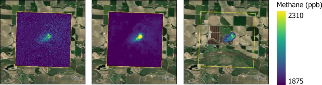
In this talk, we will present results demonstrating MethaneSAT’s ability to quantify emissions from both intensive agriculture systems and in dispersed pastoral agriculture. We will show analysis of data from over 200 individual agricultural scenes over the United States from MethaneAIR, an airborne precursor instrument to MethaneSAT, which suggest methane emissions from intensive agricultural systems may be systematically under-estimated due to poor quantification of emissions from animal waste.
Second IEEE GRSS NZ Radar Remote Sensing School 2026 (NZRRSS)
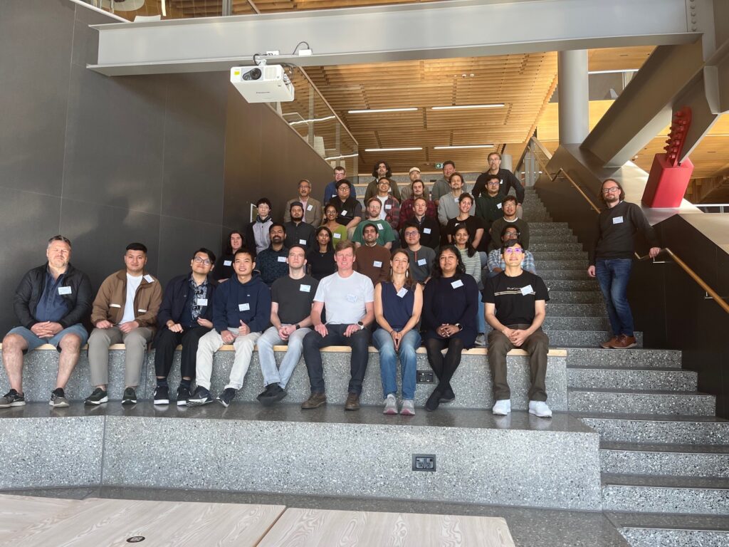
We had a fantastic turnout to the Second IEEE GRSS NZ Radar Remote Sensing School 2026 (NZRRSS). The event was held here at the University of Canterbury (UoC) from 15 to 17 April 2026, organised by the Geoscience and Remote Sensing Society (GRSS) New Zealand Chapter and the Geospatial Research Institute (GRI), supported by the […]
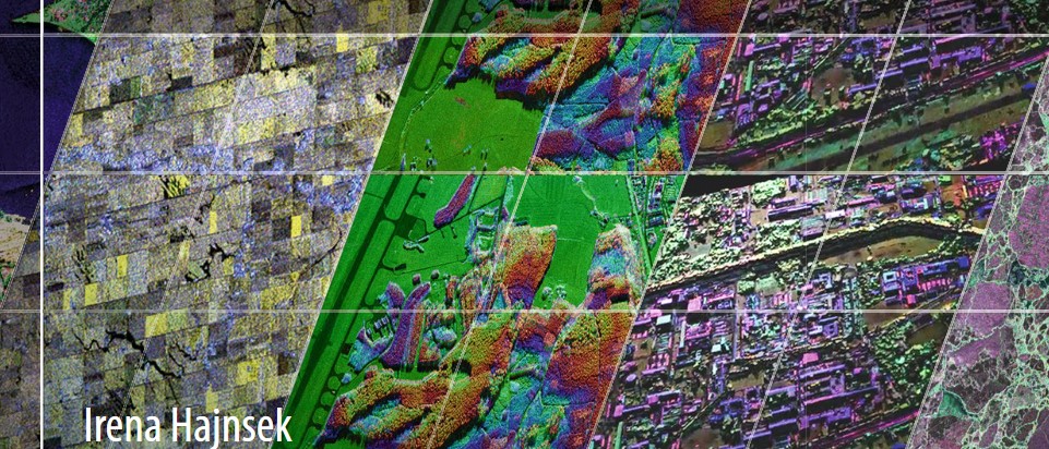
Current Trends in Synthetic Aperture Radar Imaging Techniques
The talk outlines the principles of Synthetic Aperture Radar and provides an overview of the underlying radar instrument designs and imaging techniques. It then details a specific imaging mode known as f-STEC which explores the SAR trade-space in an unusual way by time compressing the return echo. It is demonstrated how the f-STEC imaging mode can be utilised by both aforementioned trends.
Nationally Consistent Flood Hazard and Risk Information for Aotearoa
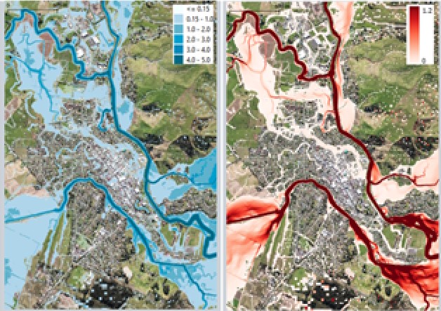
This talk will report on results from a 5-year MBIE-funded Endeavour Programme, Mā te Haumaru o te Wai on the development of a semi-automated workflow to consistently model flood hazard and risk over all of Aotearoa for current and future climates, and show results from this work that are being made available on our flood hazard and risk viewing platform to help ensure there is consistent information available.
Spatial insights for greener cities
In this seminar, we will explore the differences in health and health behaviours by neighbourhood, uncovering some of the underlying reasons for these variations in health. To better understand the range of ways in which differences in health emerge, Professor Malcolm Campbell will present a series of research projects from Te Taiwhenua o te Hauora | The GeoHealth Laboratory
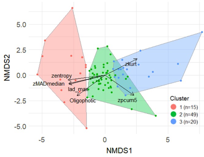
Polarimetric and Interferometric SAR for 3D Applications
In this seminar, this presentation will focus on polarimetric and interferometric Synthetic Aperture Radar techniques for environmental parameter estimation within the forest, agriculture and snow/ice domain.
Geospatial science and health: An overview of the Te Taiwhenua o te Hauora | The GeoHealth Laboratory’s impactful research over the past 20 years and what future health challenges will be tackled next
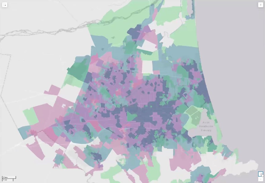
In this seminar, we will explore the differences in health and health behaviours by neighbourhood, uncovering some of the underlying reasons for these variations in health. To better understand the range of ways in which differences in health emerge, Professor Malcolm Campbell will present a series of research projects from Te Taiwhenua o te Hauora | The GeoHealth Laboratory
Mapping the path to better health: Unleash the superpower of geohealth
What if maps could lead to better health and well-being for you and your community? Imagine using maps and data to improve our lives, helping us live longer and healthier lives. Join us on a journey as we show you how we make this happen!
New Zealand SAR Mission Hackathon
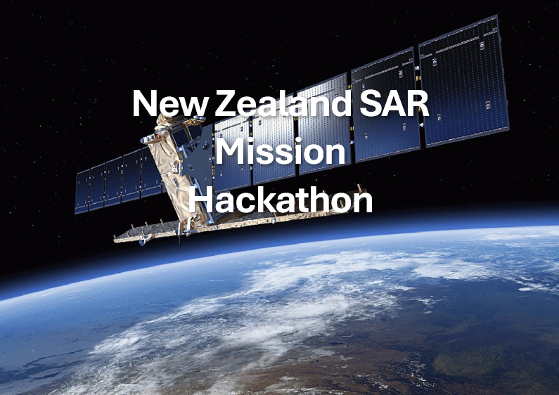
The hackathon, a collaborative event, is open to undergraduate or postgraduate students interested in improving their radar technology expertise through mission design.