
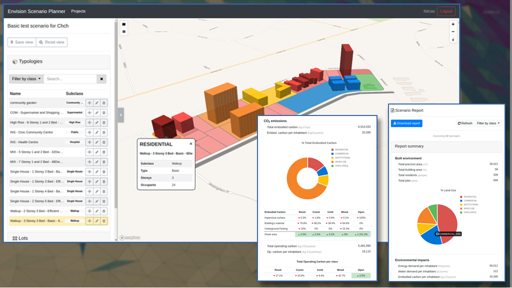
Greening the Greyfields
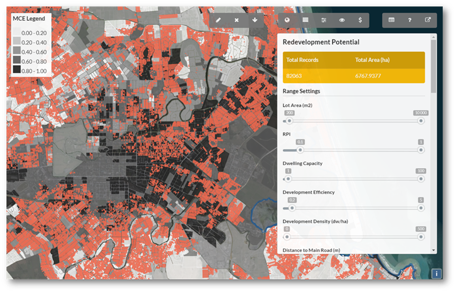
Research team Simon Kingham Rita Dionisio Funding CRCSI Duration 2017 Collaborators Christchurch City Council, Curtin University and Swinburne University Project summary The CRCSI ‘Greening the Greyfields’ project was a joint NZ/Australia project to develop a set of strategies and decision-making tools based on the strategic application of geospatial information to urban planning with a view […]
Carbon Neutral Neighbourhoods dashboard development

Research team Malcolm Campbell (GeoHealth Lab – UoC) Lindsey Conrow (SEE – UoC) Tom Logan (Civil and Natural Resources Engineering – UoC) Simon Kingham (SEE – UoC) Dashboard development: Malcolm Campbell (GeoHealth Lab – UoC) Luke Parkinson (GRI – UoC) Matthew Wilson (GRI – UoC) Funding BRANZ – Funded from the Building Research Levy Duration […]
Urban Trees and Housing Intensification: A Spatial Conflict?
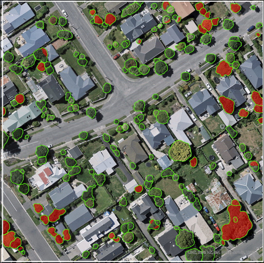
PhD StudentDavid Pedley (SoF- GRI) SupervisorsDr Justin Morgenroth (UoC)Dr Grant Pearse (Flinders University)Mijam Schindler (Victoria University) FundingGRI Scholarship and UC Doctoral Scholarship Project summary Achieving a sustainable city requires balancing two essential elements: housing and urban trees. The provision of high-quality and affordable housing is necessary to enable occupation by a diversity of residents who […]
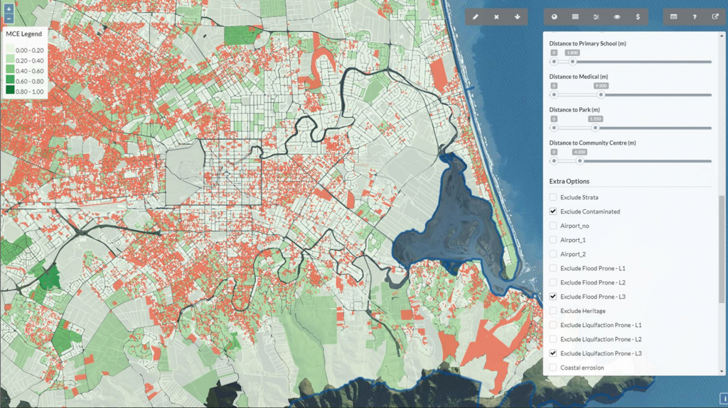
Building urban development scenarios into assessments of future flood risk
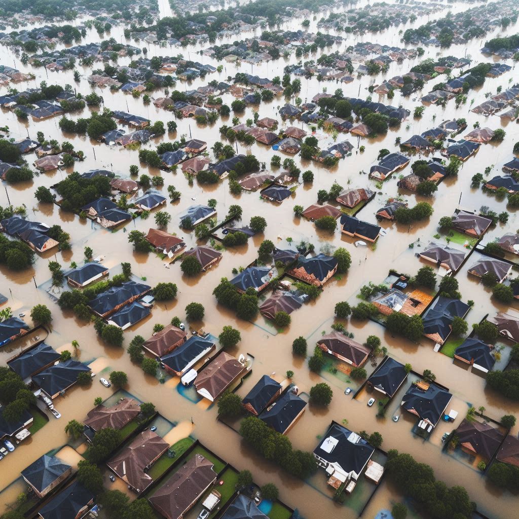
PhD student:Katherine Booker (UoW) Supervisors:Iain White (UoW)Matthew Wilson (GRI – UoC)Xinyu Fu (UoW) Funding:MBIE Endeavour Research Programme – Increasing flood resilience across Aotearoa, New Zealand Duration of Project2023 – 2026 Summary:Flooding is one of the costliest natural hazards in Aotearoa-New Zealand, and with a warming climate is expected to become more frequent and more severe […]
Map-based tools for Community and Rūnanga-led sustainable town planning, in small and medium settlements in New Zealand

Researchers: Rita Dionisio (Principal investigator, GRI and SEE-TKA) Dean Walker (Post-doctoral fellow GRI) Ines Falco (Software developer GRI) Sharmila Savarimuthu (Software developer GRI) Luke Parkinson (Software developer GRI) Professor Hirini Matunga (key researcher, Lincoln University) Professor Angus Macfarlane (key researcher, UC, Te Arawa and Ngāti Whakaue) Professor Simon Kingham (key researcher, UC) Collaborators: Ruiha and […]
Map-based tools for community and Runanga-led sustainable town planning
Building Better Homes, Towns and Cities Next Generation Information for Better Outcomes Overview Map-based tools for community and Runanga-led sustainable town planning Research Team: Simon Kingham Rita Dionisio-McHugh Mirjam Schindler Duration 2017 Funding MBIE Project summary Current urban and town planning processes in Aotearoa present few ways to include local knowledge and bicultural views in […]
Geospatial data availability, quality, needs
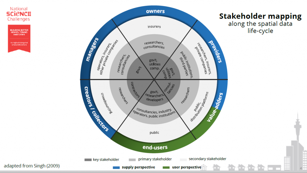
Building Better Homes, Towns and Cities Next Generation Information for Better Outcomes Project 2 Geospatial tools for better decision-making in urban planning Research Team: Simon Kingham Mirjam Schindler Rita Dionisio-McHugh Duration 2017 Funding MBIE Project summary New Zealand’s urban planning community faces challenges regarding the availability and accessibility of fit-for-purpose (spatial) data. Gaining useful information about […]
The Building Better Homes Towns and Cities: Ko ngā wā kāinga hei whakamahorahora
Building Better Homes, Towns and Cities Next Generation Information for Better Outcomes Overview The Building Better Homes Towns and Cities: Ko ngā wā kāinga hei whakamahorahora Research team Simon Kingham Rita Dionisio Mirjam Schindler Duration 2017 Funding MBIE Project summary The Building Better Homes Towns and Cities: Ko ngā wā kāinga hei whakamahorahora National Science […]
Geospatial tools for better decision-making in urban planning
Urban planning and regeneration in Aotearoa is posed with a number of complexities, related to how decisions are informed through current evidence for better social, environmental and economic outcomes at the city and neighbourhood scales.