
Research team
Michael Healey (Christchurch City Council)
Frances Charters (University of Canterbury)
Kerri Gray (CreateBig)
Matthew Wilson (University of Canterbury)
Greg Preston (University of Canterbury)
John Reid (University of Canterbury)
Luke Parkinson (University of Canterbury)
Xander Cai (University of Canterbury)
Martin Nguyen (University of Canterbury)
Casey Li (University of Canterbury)
Rory Clifford (University of Canterbury)
Sam Thompson (University of Auckland)
Aporini Deer (University of Canterbury)
Alistair McIntyre (Open Plan)
Marcos Gabriel Merlo
Funding
Christchurch City Council and Business Innovation Partnership
Project summary
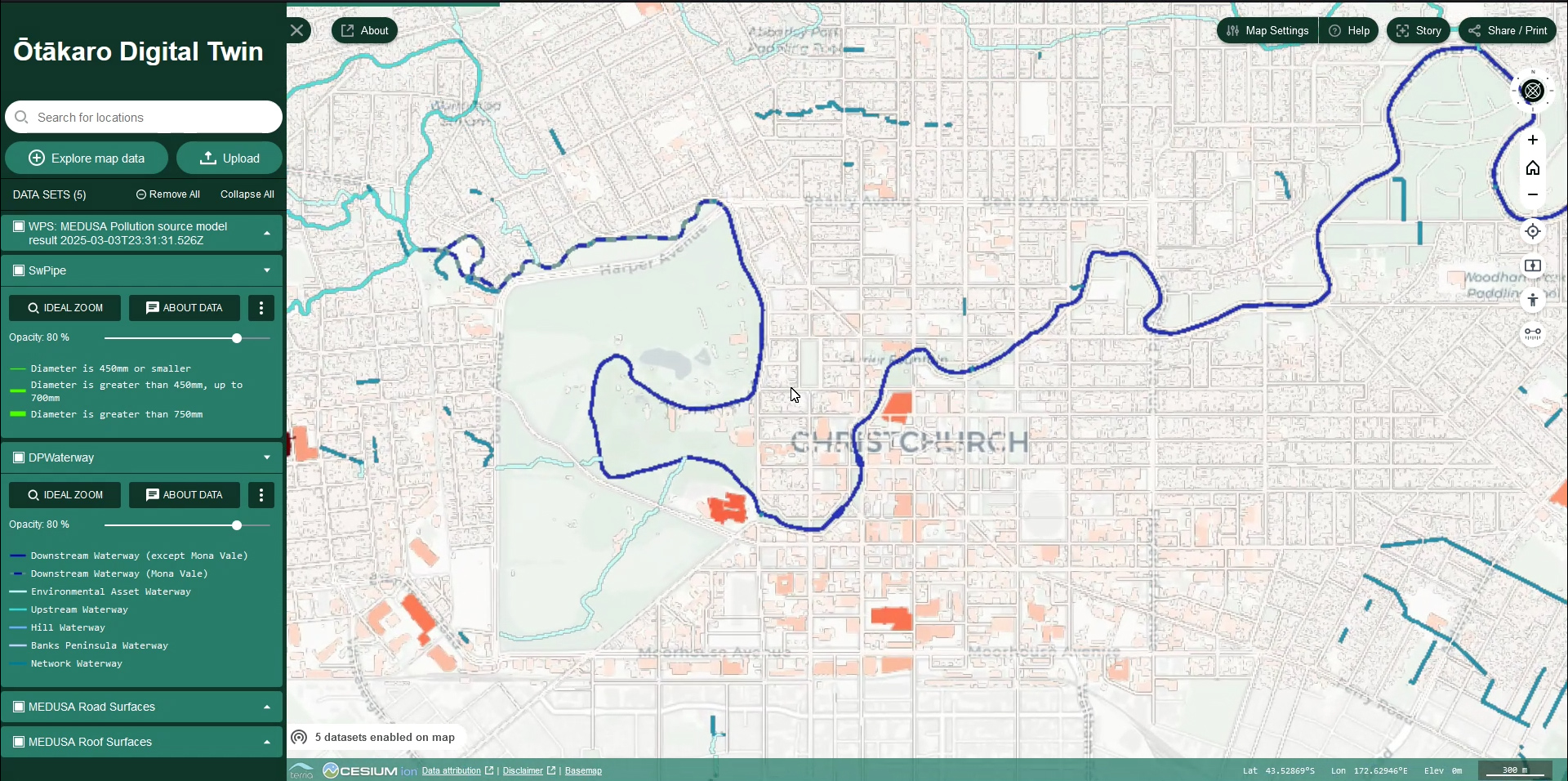
The aim of this project was to establish an accessible and innovative platform to collect and communicate knowledge about the Ōtākaro River, serving as a tool to give voice to the Ōtākaro (Avon River) and its importance to the community.
The platform aims to foster collaboration to support and encourage:
- Holistic decision making & governance, to restore te mauri o te awa,
- Environmental health and resilience outcomes,
- Representation of the mauri of the Ōtākaro and;
- Amplify the significance of the Ōtākaro to the region and people by allowing users to model potential future narratives and tell stories of the Ōtākaro’s past & present.
The Ōtākaro Digital Twin purpose is guided by the Te Mana o te Wai framework and is expected to be adaptable to other locations and environments.
VR visualisation
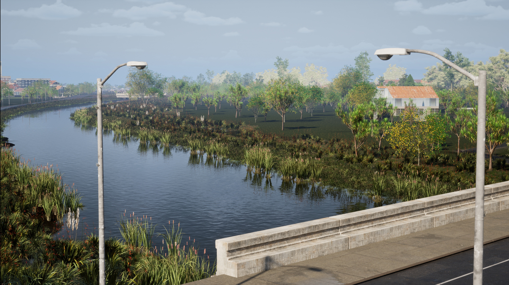
Using geospatial data and model outputs, a VR visualisation of a future scenario for a proposed development of red zone land and native vegetation restoration was developed by the GRI team, with the aim of facilitate the public engagement with environmental contexts and potential changes.

