
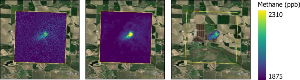
Quantifying agricultural CH4 emissions using MethaneSAT, MethaneAIR and ground-based data
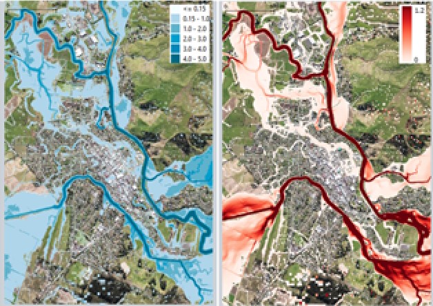
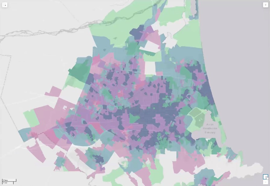
This talk will report on results from a 5-year MBIE-funded Endeavour Programme, Mā te Haumaru o te Wai on the development of a semi-automated workflow to consistently model flood hazard and risk over all of Aotearoa for current and future climates, and show results from this work that are being made available on our flood hazard and risk viewing platform to help ensure there is consistent information available.
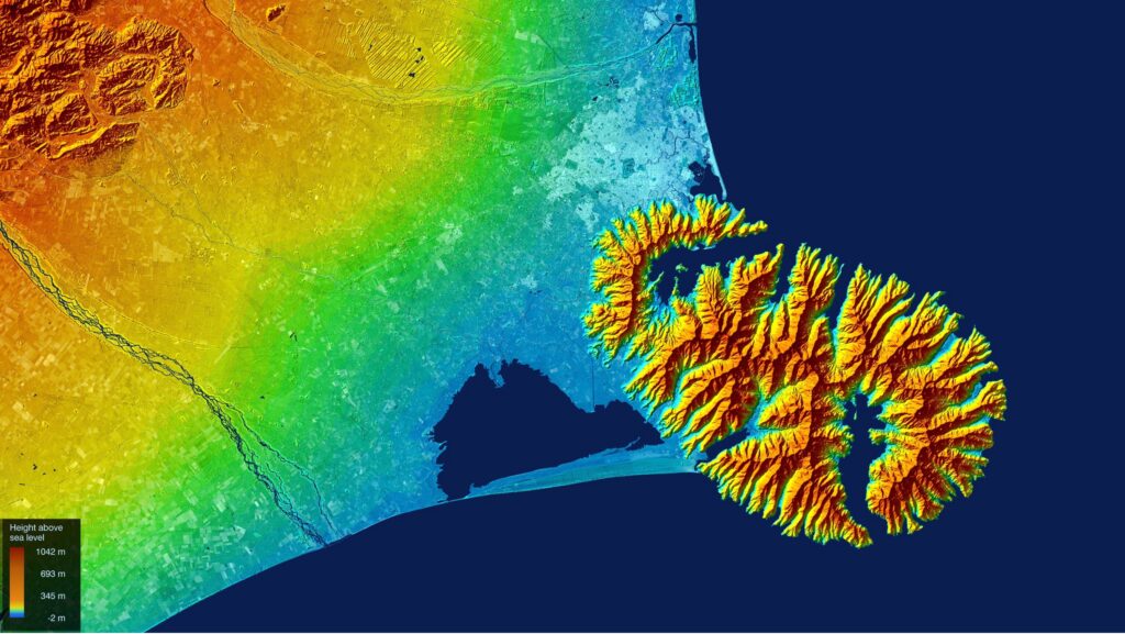
Current Trends in Synthetic Aperture Radar Imaging Techniques
This talk will report on results from a 5-year MBIE-funded Endeavour Programme, Mā te Haumaru o te Wai on the development of a semi-automated workflow to consistently model flood hazard and risk over all of Aotearoa for current and future climates, and show results from this work that are being made available on our flood hazard and risk viewing platform to help ensure there is consistent information available.
Nationally Consistent Flood Hazard and Risk Information for Aotearoa
This talk will report on results from a 5-year MBIE-funded Endeavour Programme, Mā te Haumaru o te Wai on the development of a semi-automated workflow to consistently model flood hazard and risk over all of Aotearoa for current and future climates, and show results from this work that are being made available on our flood hazard and risk viewing platform to help ensure there is consistent information available.
Spatial insights for greener cities
In this seminar, we will explore the differences in health and health behaviours by neighbourhood, uncovering some of the underlying reasons for these variations in health. To better understand the range of ways in which differences in health emerge, Professor Malcolm Campbell will present a series of research projects from Te Taiwhenua o te Hauora | The GeoHealth Laboratory
Polarimetric and Interferometric SAR for 3D Applications
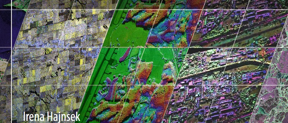
In this seminar, this presentation will focus on polarimetric and interferometric Synthetic Aperture Radar techniques for environmental parameter estimation within the forest, agriculture and snow/ice domain.
Geospatial science and health: An overview of the Te Taiwhenua o te Hauora | The GeoHealth Laboratory’s impactful research over the past 20 years and what future health challenges will be tackled next
In this seminar, we will explore the differences in health and health behaviours by neighbourhood, uncovering some of the underlying reasons for these variations in health. To better understand the range of ways in which differences in health emerge, Professor Malcolm Campbell will present a series of research projects from Te Taiwhenua o te Hauora | The GeoHealth Laboratory
Mapping the path to better health: Unleash the superpower of geohealth
What if maps could lead to better health and well-being for you and your community? Imagine using maps and data to improve our lives, helping us live longer and healthier lives. Join us on a journey as we show you how we make this happen!
The Kaitiaki Intelligence Platform: Integrating mātauranga Māori, artificial intelligence, and sensing technologies in the design of an environmental sensing network.

Dr John Reid be giving a talk called The Kaitiaki Intelligence Platform: Integrating mātauranga Māori, artificial intelligence, and sensing technologies in the design of an environmental sensing network.
How much habitat is enough?
In this seminar, Dr Cristina Banks-Leite will talk about ecological thresholds as a was to estimate the minimum amount of habitat required to preserve biodiversity, and how the position of thresholds changes across biomes world-wide.
Radio localisation: Understanding insect behaviour, busting sport cheats and studying climate change.
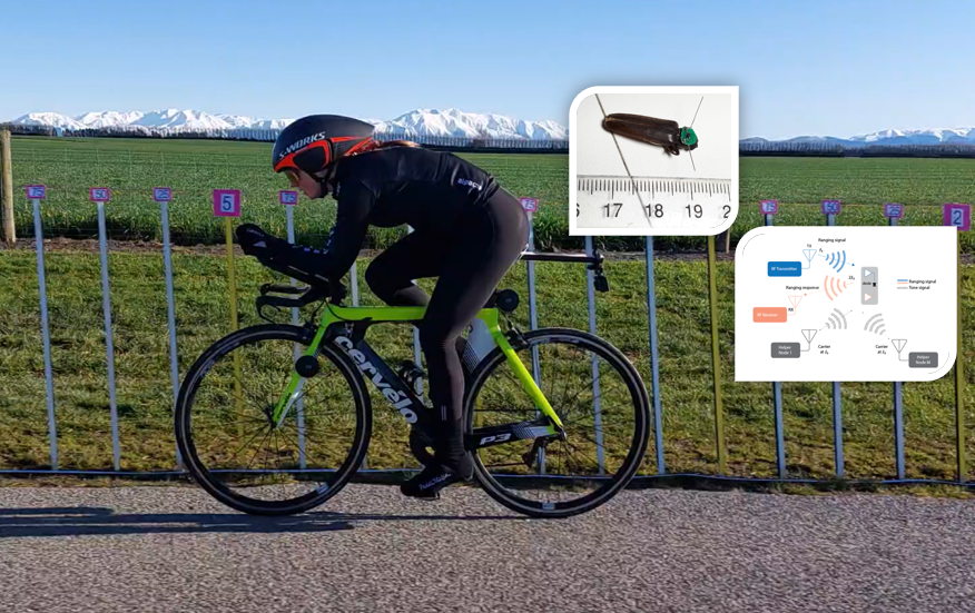
In this seminar, Dr Graeme Woodward will be introducing some of the work at UC’s Wireless Research Centre.