
Te Kete Kōrero o Ōhinemutu; Geospatial tool for community & Māori-led planning
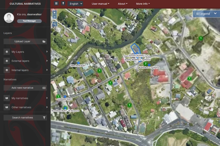
Te Kete Kōrero o Ōhinemutu is a Mātauranga Māori map-based tool co-created by the community of Ōhinemutu and the Geospatial Research Institute Toi Hangarau. Ōhinemutu is a village with deep connection to Ngāti Whakaue. Built on the shores of Lake Rotorua, it is famed for its geothermal features and Te Papa-i-Ouru marae. Te Kete Kōrero o Ōhinemutu has been built to hold and share historical narratives of Ōhinemutu as well as current community initiatives. The range of narratives includes traditional, historic, scientific and lived experiences.
Geospatial Research Seminar Series (GRISS) – 27 November 2020
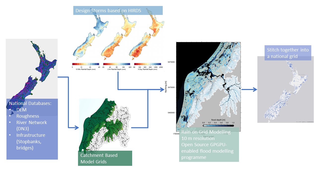
Flooding is Aotearoa/New Zealand’s most frequent hazard and its impact will only increase under climate change through both more intense rainfall events and sea level rise. We are currently going through a massive flooding infrastructure revamp as well as investing in significant urban development. However, we don’t yet have a consistent national understanding of what our flood risk is now – let alone in the future.