
Geospatial Research Seminar Series (GRISS) – 30 April 2021
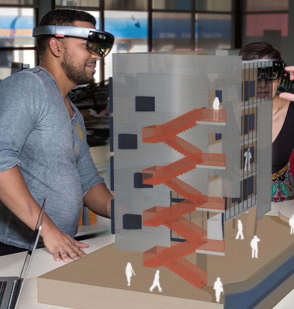
Much has been written about the need to unlock the power of data and digital methods to improve the performance of infrastructure and productivity of the building industry. Recognising the potential benefits of these methods, the New Zealand Government and building industry are co-investing in an eight-year (2018-2026) research programme, under the banner of the Building Innovation Partnership (BIP), to accelerate digitalisation of the infrastructure sector. This industry-led programme has to date focused on two applications of data and digital methods.
Geospatial Research Seminar Series (GRISS) – 5 March 2021

Global Satellite Navigations Systems such as GPS enable positioning information accurate to about 5-10 metres. A Satellite Based Augmentation System (SBAS) will improve the accuracy to less than a metre, and in some devices to 10 centimetres, and provide greater integrity. More precise and accurate positioning increases our productivity, secures our safety and enables innovation. Unlike most regions of the developed world where SBAS is available, Australasia does not currently have access to any reliable free-to-air augmentation services. LINZ and Geoscience Australia are working together to develop a regional SBAS to improve the accuracy of GPS.
Geospatial Research Seminar Series (GRISS) – 27 November 2020
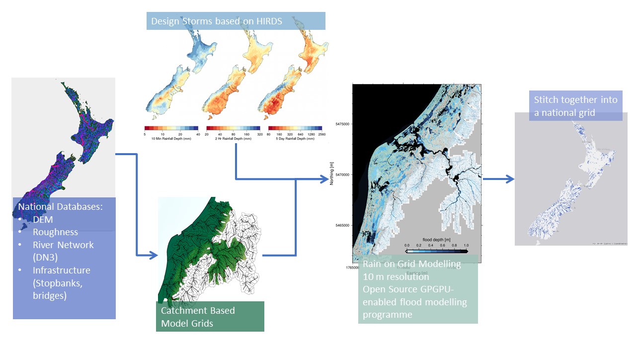
Flooding is Aotearoa/New Zealand’s most frequent hazard and its impact will only increase under climate change through both more intense rainfall events and sea level rise. We are currently going through a massive flooding infrastructure revamp as well as investing in significant urban development. However, we don’t yet have a consistent national understanding of what our flood risk is now – let alone in the future.