
GRI Director, Prof Matthew Wilson presents in Europe
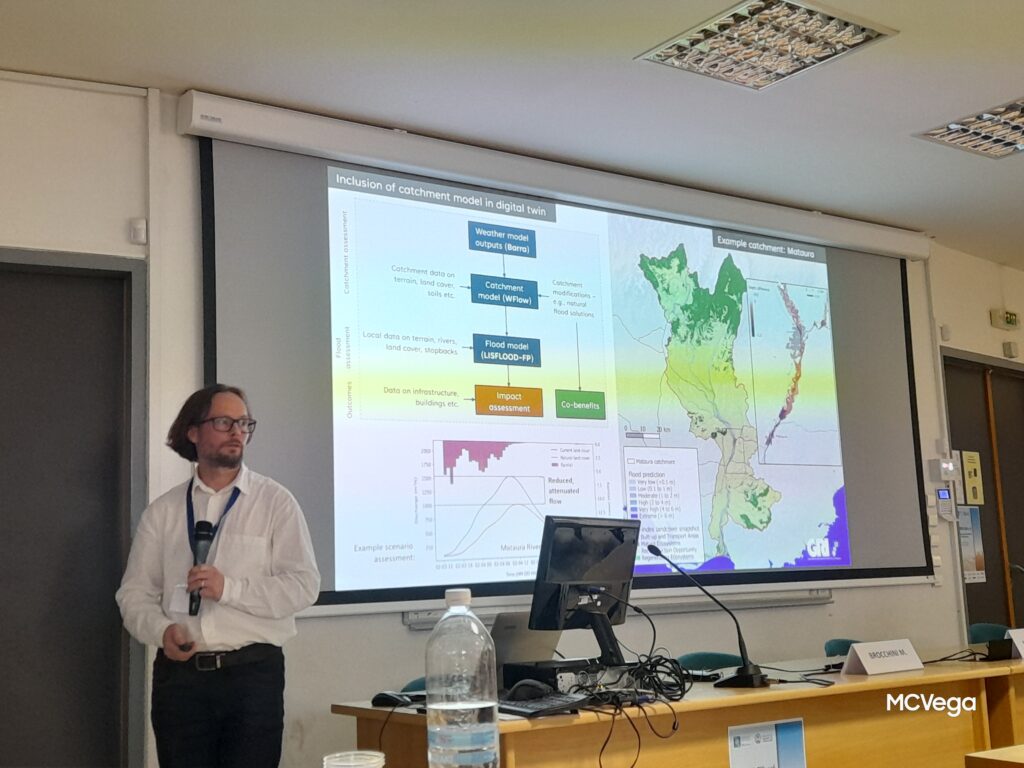
Prof Matthew Wilson began his sabbatical this July by giving talks in Greece and Italy. He attended the River Flow Conference (13th International Conference on Fluvial Hydraulics) in Thessaloniki, Greece on July 4th, 2026. He presented at talk called “Digital twins can empower decision makers for improved management of flood risk”. On July 9th he visited […]
Astronaut Katherine Bennell-Pegg Inspires the University of Canterbury Audience with Vision for Space Future
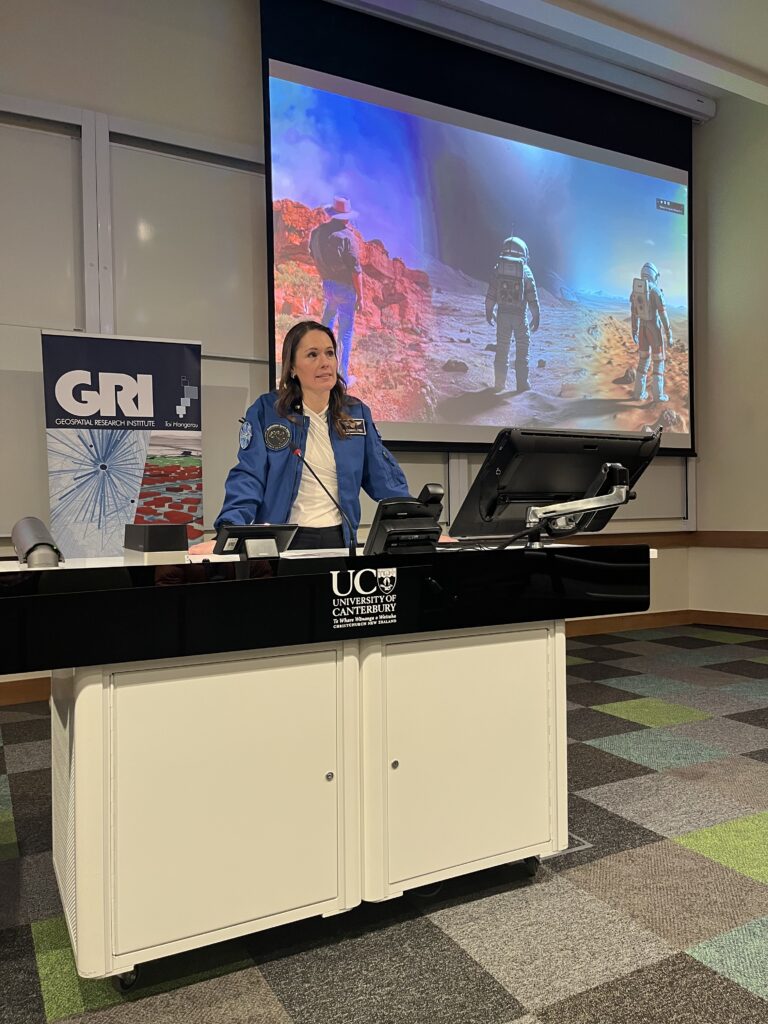
Astronaut Katherine Bennell-Pegg (Director at the Australian Space Agency) delivered an inspiring talk at the University of Canterbury outlining the future of space exploration, the realities of astronaut training, and the growing opportunities for New Zealand and Australia in the rapidly expanding space economy.
Two Nations, One Orbit: How Australia and New Zealand are making their mark in the global space sector

Hear from astronaut and 2026 Australian of the Year, Katherine Bennell-Pegg about how our two countries are cutting through on the global space stage. Katherine will also share about her journey to becoming a professional astronaut and the lessons from her training that can benefit Australia and New Zealand.
GRI in the News: AI-powered system set to transform water use for farmers
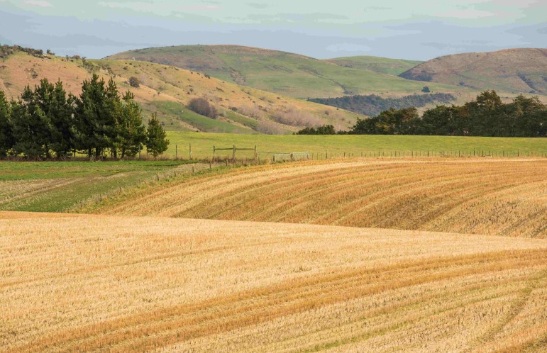
Researchers from UC’s Toi Hangarau | Geospatial Research Institute, led by Professor Matthew Wilson and Xander Cai, are developing a cutting-edge AI-driven system to help farmers better understand and manage one of their most critical resources: water. The new ANZ Soil Moisture Data Assimilation System (ANZ-SMDAS) combines ground sensors, satellite signals, and advanced modelling to […]
Quantifying agricultural CH4 emissions using MethaneSAT, MethaneAIR and ground-based data
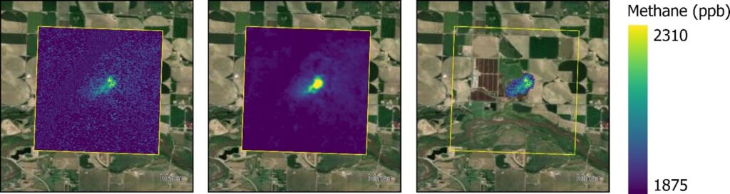
In this talk, we will present results demonstrating MethaneSAT’s ability to quantify emissions from both intensive agriculture systems and in dispersed pastoral agriculture. We will show analysis of data from over 200 individual agricultural scenes over the United States from MethaneAIR, an airborne precursor instrument to MethaneSAT, which suggest methane emissions from intensive agricultural systems may be systematically under-estimated due to poor quantification of emissions from animal waste.
Current Trends in Synthetic Aperture Radar Imaging Techniques
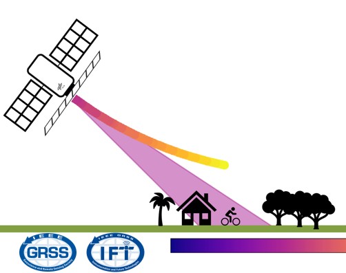
The talk outlines the principles of Synthetic Aperture Radar and provides an overview of the underlying radar instrument designs and imaging techniques. It then details a specific imaging mode known as f-STEC which explores the SAR trade-space in an unusual way by time compressing the return echo. It is demonstrated how the f-STEC imaging mode can be utilised by both aforementioned trends.
GRI Holiday BBQ at Spencer Park
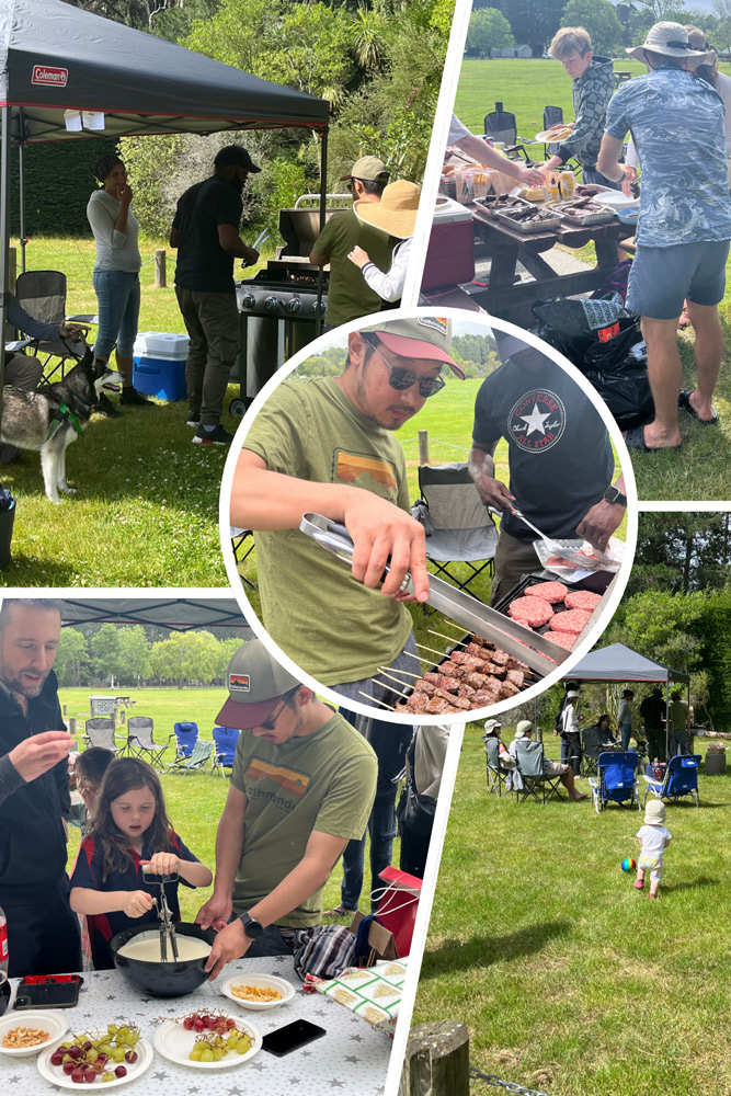
We had a great turn out to the annual GRI Holiday Party! Nearly forty GRI staff, students, family, and friends came for an afternoon of sun, lemonade, BBQ, pavlova, and secret Santa.
Nationally Consistent Flood Hazard and Risk Information for Aotearoa
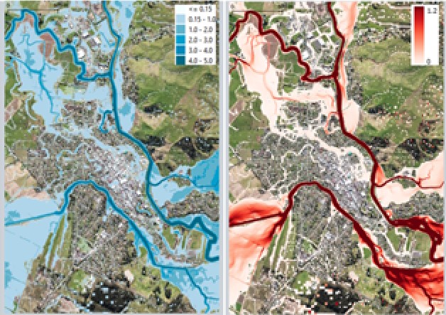
This talk will report on results from a 5-year MBIE-funded Endeavour Programme, Mā te Haumaru o te Wai on the development of a semi-automated workflow to consistently model flood hazard and risk over all of Aotearoa for current and future climates, and show results from this work that are being made available on our flood hazard and risk viewing platform to help ensure there is consistent information available.
Thanks to everyone who came to chat with the Geospatial Research Institute Toi Hangarau team at the University of Canterbury booth at Adaptation Futures 2025!
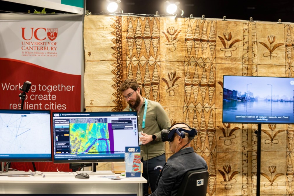
It was a busy and rewarding three days of demonstrations of our work in the adaptation space, including web apps for assessing how healthy communities are, a transport carbon emissions scenario planner, the Ōtakaro Digital Twin including predicted pollutant runoff from urban surfaces, and the Flood Resilience Digital Twin, enabling automated assessments of flood risk […]
Spatial insights for greener cities
In this seminar, we will explore the differences in health and health behaviours by neighbourhood, uncovering some of the underlying reasons for these variations in health. To better understand the range of ways in which differences in health emerge, Professor Malcolm Campbell will present a series of research projects from Te Taiwhenua o te Hauora | The GeoHealth Laboratory