
The Kaitiaki Intelligence Platform: Integrating mātauranga Māori, artificial intelligence, and sensing technologies in the design of an environmental sensing network.

Dr John Reid be giving a talk called The Kaitiaki Intelligence Platform: Integrating mātauranga Māori, artificial intelligence, and sensing technologies in the design of an environmental sensing network.
Mātauranga Maori Framework for Surveillance (MMFS) for Plant Pathogens
In the past, there has been a disconnect and little collaboration between the people and organizations doing work on plant pathogens that cause myrtle rust and kauri dieback. This has stymied progress in the management of plant pathogens and diseases, and is still unclear where they occur or not. Here we introduce the principles and methodologies of the Mātauranga Māori Framework for surveillance (MMFS) for plant pathogens.
Video recording available at:
https://www.youtube.com/watch?v=3Czj2fB_1iU&list=PLJymSfBIuEWKYLJbi6LzyiRXKtAQBbcH3&index=4
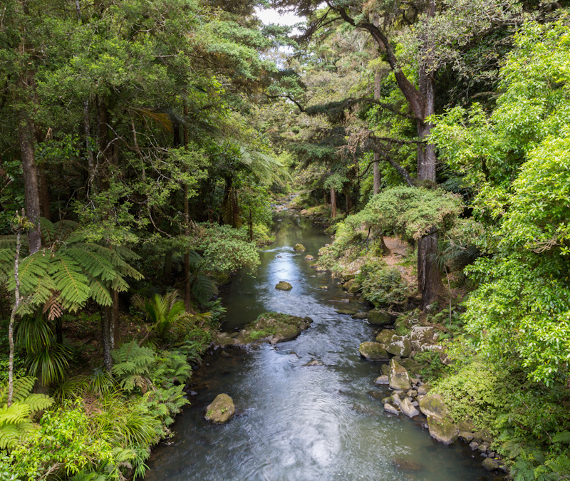
Te Kete Kōrero o Ōhinemutu; Geospatial tool for community & Māori-led planning
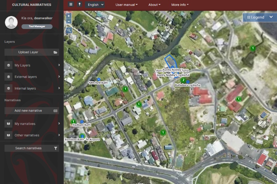
Te Kete Kōrero o Ōhinemutu is a Mātauranga Māori map-based tool co-created by the community of Ōhinemutu and the Geospatial Research Institute Toi Hangarau. Ōhinemutu is a village with deep connection to Ngāti Whakaue. Built on the shores of Lake Rotorua, it is famed for its geothermal features and Te Papa-i-Ouru marae. Te Kete Kōrero o Ōhinemutu has been built to hold and share historical narratives of Ōhinemutu as well as current community initiatives. The range of narratives includes traditional, historic, scientific and lived experiences.
Geospatial Research Seminar Series (GRISS) – 25 June 2021
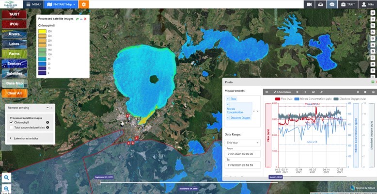
Takiwā is an award winning data management and analytics platform that allows end-users to upload, analyse and present multiple types of data and information within a spatial context in order to solve complex problems. A critical design feature of Takiwā has been the ability to draw together cultural and maatauranga Māori data and information alongside Western scientific data while managing cultural and commercial sensitivities of any datasets. Takiwā CEO Mike Taitoko will introduce the Takiwā platform and illustrate how it can help to empower…
New GRI PhD student – Olivia Willoughby
GRI welcomes a new PhD student, Olivia Willoughby Olivia will be working on the topic of Spatial variations in Māori health outcomes, supervised by Prof. Simon Kingham and Dr. Malcolm Campbell and funded by a GeoHealth scholarship from the Ministry of Health, New Zealand. Olivia says “I started at UC a few years ago when […]