
Geospatial Research Seminar Series (GRISS) – 24 September 2021 – Recorded
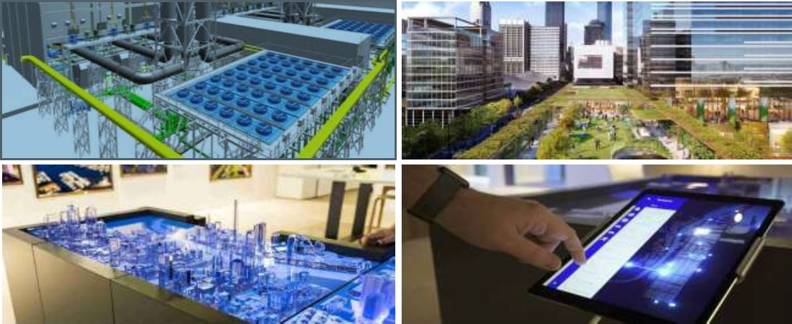
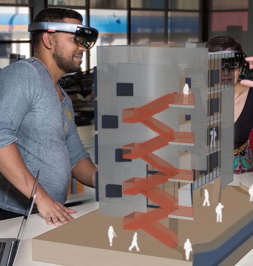
Keri is a passionate Digital Technologist, with a strong background in Geospatial technologies, and over 20 years of international experience in designing enterprise collaboration platforms. Keri is the New Zealand Digital Practice Leader and is focused on identifying digital possibilities and creating opportunities to embed new technologies into our organisational way of working. Keri represents Aurecon on the ANZ Smart Cities Council and on the ANZ Digital Twin Taskforce.
Geospatial Research Seminar Series (GRISS) – 30 July 2021
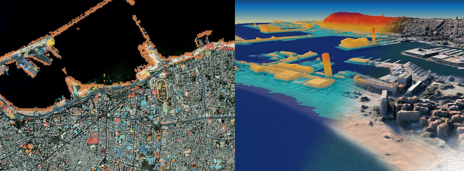
In this time of rapid global change, we need new ways to identify, monitor and understand the impact of change on environments and human dynamics such as economy, health and sociopolitical stability. Maxar Earth Intelligence capabilities help customers map, detect, address and predict change at unprecedented speed and scale. Fueled largely by Maxar’s own constellation of high-resolution imaging satellites and combining multi-source data and applied artificial intelligence, machine learning and rich domain knowledge is able to deliver insight as a service.
Geospatial Research Seminar Series (GRISS) – 25 June 2021
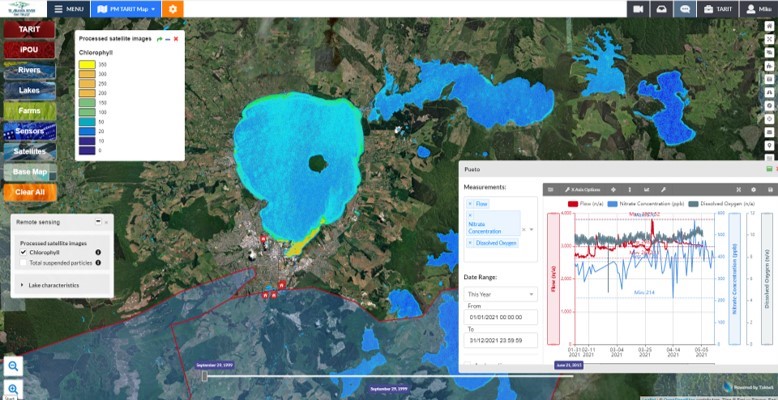
Takiwā is an award winning data management and analytics platform that allows end-users to upload, analyse and present multiple types of data and information within a spatial context in order to solve complex problems. A critical design feature of Takiwā has been the ability to draw together cultural and maatauranga Māori data and information alongside Western scientific data while managing cultural and commercial sensitivities of any datasets. Takiwā CEO Mike Taitoko will introduce the Takiwā platform and illustrate how it can help to empower…
Geospatial Research Seminar Series (GRISS) – 28 May 2021
NZ now has a tool that has been developed to identify high risk locations for safety interventions in order to reduce the horrific financial and emotional cost of road fatalities. The Safer Journeys Risk Assessment Tool or more commonly, ‘MegaMaps’, and has been produced by Waka Kotahi NZ Transport Agency with the assistance of Abley, a national professional services firm. The tool is a significant asset for New Zealand. This presentation will explain the tool, how it came to exist and why it is unique nationally and globally.
Geospatial Research Seminar Series (GRISS) – 30 April 2021
Much has been written about the need to unlock the power of data and digital methods to improve the performance of infrastructure and productivity of the building industry. Recognising the potential benefits of these methods, the New Zealand Government and building industry are co-investing in an eight-year (2018-2026) research programme, under the banner of the Building Innovation Partnership (BIP), to accelerate digitalisation of the infrastructure sector. This industry-led programme has to date focused on two applications of data and digital methods.
Geospatial Research Seminar Series (GRISS) – 5 March 2021
Global Satellite Navigations Systems such as GPS enable positioning information accurate to about 5-10 metres. A Satellite Based Augmentation System (SBAS) will improve the accuracy to less than a metre, and in some devices to 10 centimetres, and provide greater integrity. More precise and accurate positioning increases our productivity, secures our safety and enables innovation. Unlike most regions of the developed world where SBAS is available, Australasia does not currently have access to any reliable free-to-air augmentation services. LINZ and Geoscience Australia are working together to develop a regional SBAS to improve the accuracy of GPS.
Geospatial Research Seminar Series (GRISS) – 27 November 2020
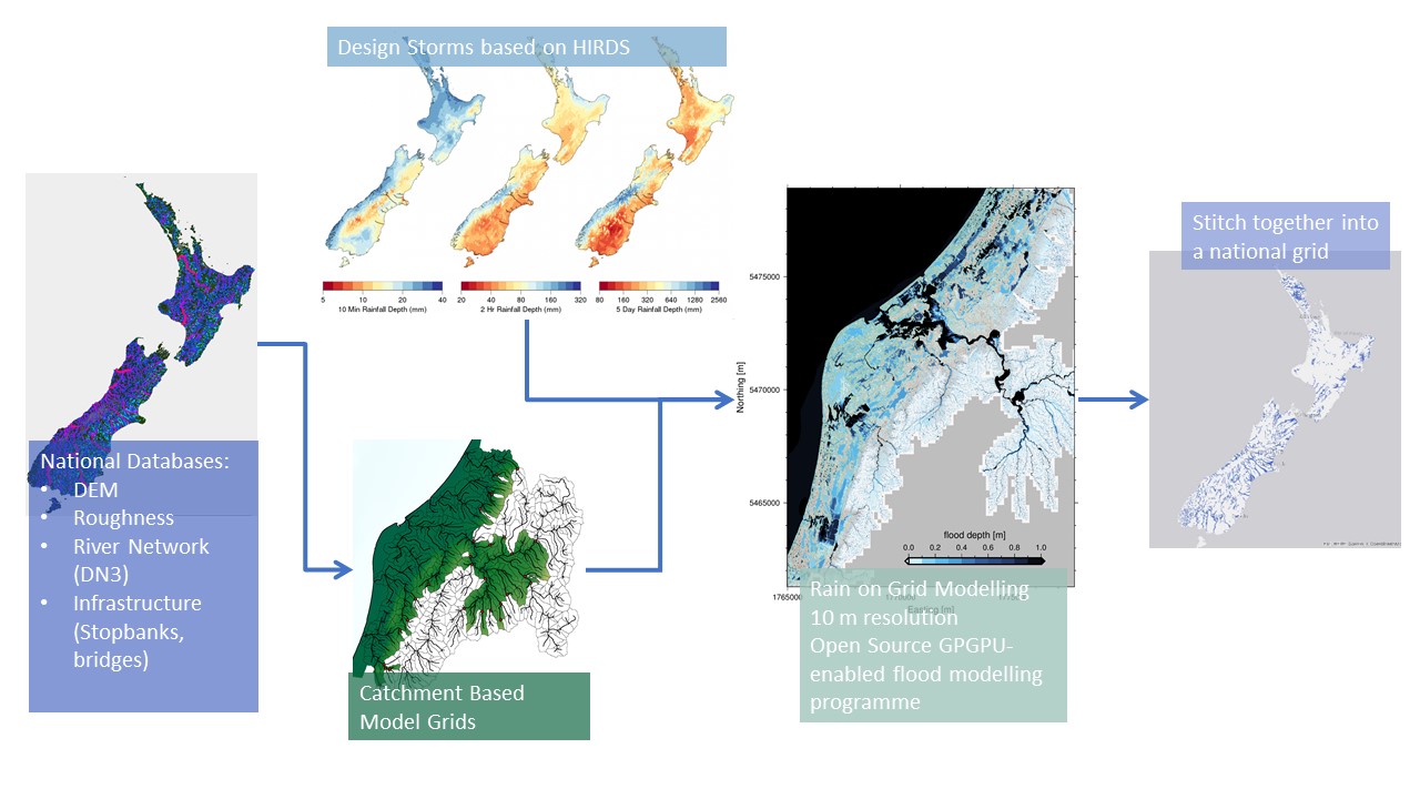
Flooding is Aotearoa/New Zealand’s most frequent hazard and its impact will only increase under climate change through both more intense rainfall events and sea level rise. We are currently going through a massive flooding infrastructure revamp as well as investing in significant urban development. However, we don’t yet have a consistent national understanding of what our flood risk is now – let alone in the future.
Geospatial Research Seminar Series (GRISS) – 25 September 2020 (online & in person)
Prof Sabel is a spatial data scientist working in the nexus between health and spatial data informatics. He is Director, BERTHA – Big Data Centre for Environment and Health at Aarhus University, but previously worked at the University of Canterbury, Department of Geography as a GISc lecturer. The BERTHA Big Data Centre for Environment and Health at Aarhus University, Denmark, aims to muster the huge potential opportunities from the Big Data revolution to help us understand the complex interactions between environmental pollutants and human health.
GEOSPATIAL RESEARCH SEMINAR SERIES (GRISS) – 25 October 2019

The Geospatial Research Institute is pleased to host Dr Kat Salm. Kat has been working in the spatial industry in New Zealand across government, industry, and research/education for a number of years. She is also the winner of the 2018 New Zealand Spatial Excellence Awards (NZSEA) in the category “Women’s Leadership Award”, as well as the 2019 Asia-Pacific Spatial Excellence Awards (APSEA).
GEOSPATIAL RESEARCH SEMINAR SERIES (GRISS) – 27 September 2019
Regional Councils collect a lot of environmental data. We’re good at it and it is hugely valuable to our policy decisions and general environmental management. A recent valuation of the Environment Canterbury hydrological database was $4.2 billion, based on a mixture of the collection costs and the value of decisions made with those data. With all that data comes the challenge of data management and more importantly; how to tell a coherent story of “what’s going on”. This seminar will set out the types of data collected by Environment Canterbury and discuss possibilities for telling environmental stories in a better way.