
Te Awarua-o-Porirua Harbour flow model: Phase 1
Project leaders Georgina Dawson (Māori Impact Manager – ESR) Matthew Wilson (University of Canterbury) Russleigh Parai (Māori Impact – ESR) Funding Institute of Environmental Science and Research Limited (“ESR”) Project summary A flow model of the Porirua Harbour with water source tracing capability was developed to enable an assessment of where is likely to be […]
Nationwide geospatial study of water fluoridation
Research Team: Matthew Hobbs (SoH – UoC) Lukáš Marek (GRI GeoHealth Lab – UoC) Mario Puente Sierra (GRI GeoHealth Lab – UoC) Tim Chambers (Ngāi Tahu Research Centre – UoC) Funding Ministry of Health Oral Health Research Fund 2022 Duration of Project 2022-2023 (1.5 years) Project Summary Community water fluoridation (CWF) is a proven way […]
Rongowai:
Partnering to fly the Next-generation of Global Navigation Satellite System Receivers for Advancing Earth Observation
Project Team: Prof. Delwyn Moller (Project lead, University of Auckland) Prof. Matthew Wilson (GRI) Wider team: Xiaoyou Lin, Mike Laverick and Chris Seal (University of Auckland), Wayne Thomas (Air New Zealand), Chris Ruf and Steven Musko (University of Michigan), Andrew O’Brien (Ohio State University), Scott Gleason (UCAR), and others. Funding MBIE Catalyst fund and NASA […]
Reducing Flood Inundation Hazard and Risk across Aotearoa New Zealand
Project lead: Dr. Emily Lane (NIWA) GRI Team: Prof. Matthew Wilson (Uncertainty Lead) Dr Rose Pearson (NIWA/GRI visiting research fellow) Martin Nguyen (UoC PhD student) Andrea Pozo Estivariz (UoC PhD student) Katherine Booker (UoW PhD student) Clevon Ash (UoC PhD student) Funding: MBIE Endeavour Research Programme – Increasing flood resilience across Aotearoa, New Zealand. Summary: […]
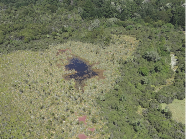
Biological Heritage Challenge: Eco-Index Programme: Sub project: The Ecosystem Detector
Research teamDr Kiri Joy Wallace (University of Waikato)Dr John Reid (J D Reid LTD)Matthew Wilson (University of Canterbury)Ngāti Pikiao (Tainu and Ngai Tahu Research Centre, University of Canterbury)Nathaniel Calhoun (Code Innovation)Kevan Cote (Moose Engineering & Design)Karen Denyer (Papawera Consulting Ltd)Saif Khan (University of Canterbury) Length of Project: 2022-2024 FundingNew Zealand National Science Challenge Eco-index Research […]
New Zealand Inventory of Dams
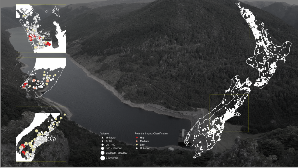
New Zealand Inventory of Dams STAGE TWO UPDATE AND ANALYSIS Stage 2 New Zealand Inventory of Dams The Ministry for the Environment (MfE) and Ministry for Business, Innovation, and Employment (MBIE) require a better understanding of New Zealand’s dam infrastructure in order to assess costs and benefits associated with a proposed regulatory dam safety scheme. The […]