
Research team
Xander Cai (GRI-UoC)
Luke Parkinson (GRI – UoC)
Casey Li (BIP – UoC)
Rose Pearson (NIWA)
Matthew Wilson (GRI – UoC)
Funding
Internal
Duration
2023 – 2025
Project summary
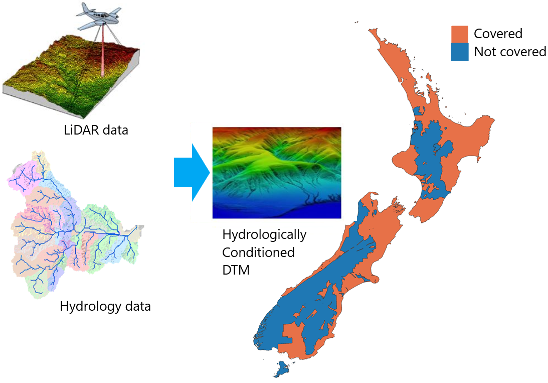
Elevation is the fundamental data in geoscience research and application. The output precision of many GRI projects relies on the accuracy of digital elevation models (DEMs). The NewZeaLiDAR project is an extensive effort to harness the power of Light Detection and Ranging (LiDAR) technology for detailed topographical analysis and hydrology monitoring across New Zealand. It aims to provide researchers, planners, and policymakers with high-resolution and high-accuracy LiDAR-derived hydrologically conditioned bear-ground DEMs through sophisticated data processing, visualisation, and analytical tools. The open-source framework of NewZeaLiDAR encourages community collaboration and continuous improvement, ensuring the project remains current and highly functional.
The project automatically crawls LiDAR datasets in New Zealand’s extent from opentopography.org and organises the vast amount of LiDAR data in storage and a database hosted on servers. It leverages the sea-draining catchment dataset from the Ministry for the Environment and other hydrological datasets to calculate and transform geospatial and hydrological data to hydrologically conditioned DEMs. A nationwide hydrologically conditioned DEM dataset is presented by conducting the processing pipeline on all the regions covered by LiDAR datasets. The users only need to input the area of interest (AOI), and the framework will retrieve the database and return the DEM of AOI in a second.
The NewZeaLiDAR project represents a significant contribution to the field of geospatial sciences and remote sensing. The effective implementation of data processing algorithms, advanced visualisation techniques, and comprehensive geospatial analysis tools underscores the project’s technical robustness and versatility. By providing tailored utilities specific to New Zealand’s diverse landscapes, NewZeaLiDAR addresses unique geospatial challenges and opens new avenues for research and practical applications.

