
Research team
Simon Kingham
Rita Dionisio
Funding
CRCSI
Duration
2017
Collaborators
Christchurch City Council, Curtin University and Swinburne University
Project summary
The CRCSI ‘Greening the Greyfields’ project was a joint NZ/Australia project to develop a set of strategies and decision-making tools based on the strategic application of geospatial information to urban planning with a view to enhancing economic, social, and environmental outcomes of urban regeneration in the middle suburbs of Australian and New Zealand cities. Given the rapid growth of these cities now, as well as expected in the coming decades, this project aimed to provide a vital platform for knowledge-informed urban planning that was aligned to a redirection of growth and investment in inner suburbs rather than outwards to the greenfields.
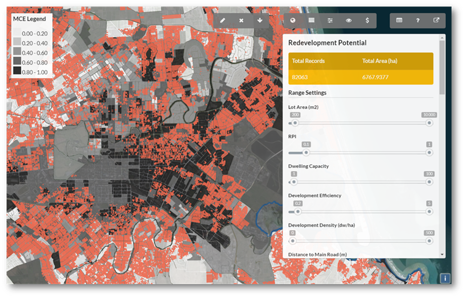
The project initially investigated the productivity impacts of more compact urban spatial patterns and developed a spatial toolset for prioritising redevelopment areas, ENVISION. This is a set of tools designed to assist community planning by highlighting areas of significant redevelopment potential and identifying prospective redevelopment precincts. It is designed as both a planning support system and a community engagement tool, allowing a variety of users to negotiate where redevelopment should (and should not) occur.
The project then aimed to develop visualisation and assessment tools and then apply them in community engagement workshops; with the aim of actualising regeneration precincts.
The outcome of the project was to provide a new set of urban development and planning strategies, and spatial assessment and visualisation tools that demonstrate the strategic harnessing and application of spatial information to inform the redevelopment of key greyfield precincts located within the middle suburbs of Christchurch and selected Australian cities.

