
Research team
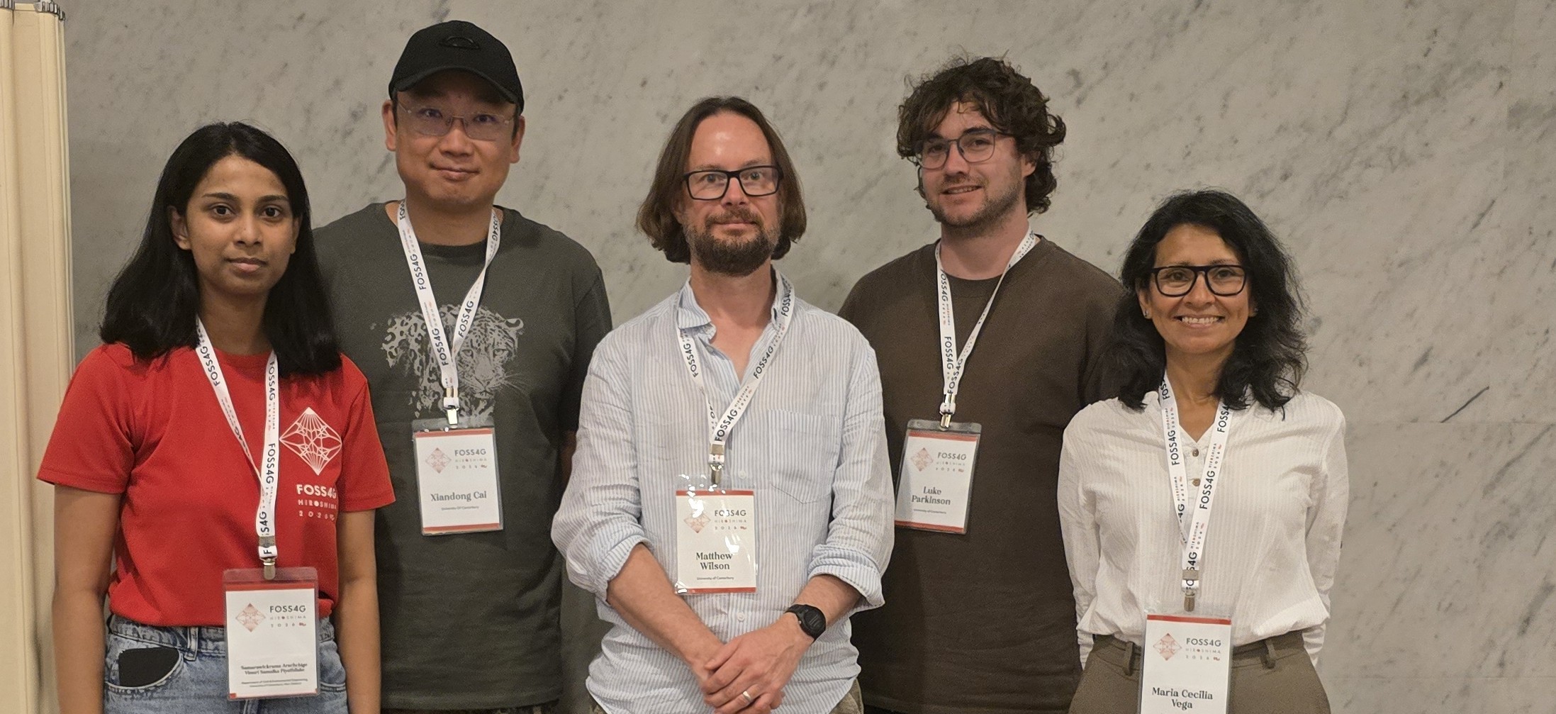
Matthew Wilson (GRI – UoC)
Matthew Hughes (CEE – UoC)
Luke Parkinson (GRI – UoC)
Martin Nguyen (GRI – UoC)
Maria Vega Corredor (GRI – UoC)
Jamie Ruwhiu (GRI – UoC)
Duration of project
October 2024 – September 2027
Funding
MBIE Endeavour (Smart Idea)
Project Summary
Flooding is a widespread and impactful hazard, frequently causing damage to housing and infrastructure, disruption to communities and businesses, and risk to human life. It is expected to intensify in the future because of climate change through increased storminess coupled with urbanisation. However, stakeholders including Māori lack the detailed, wide-ranging scenario assessments needed for complex decisions regarding mitigation and adaptation, or the means to effectively communicate these to their communities.
We are delivering a novel digital twin (DT) for climate resilience, focussing on flood risk. The system facilitates rapid, low-cost risk assessments with on-demand scenario analytics, and effective ways to visualise and communicate this risk and its associated uncertainties. With guidance from our Māori partners, the scenarios developed will ensure appropriate options are considered.
Physics-based DTs such as ours will revolutionise access to and use of numerical model predictions, through a “digital twin web” which is powered by rapidly growing data and distributed cloud computing. Yet, individual components need to be built and tested to ensure they are fit-for-purpose, democratic and adaptive to society’s needs. Our research will enable this, initially in Aotearoa, but with global applicability.
This strategic partnership consists of leaders in flood risk research, humanitarian engineering for hazards, infrastructure practitioners and Iwi leaders. Our team has successfully developed a prototype proof-of-concept DT which will form the foundation for this research. Our DT will remove barriers to flood risk assessment, greatly increasing the availability of information for resilience planning decisions. It will improve communication and understanding of flood risks, and enable communities to be better informed, prepared, and engaged in mitigation and adaptation.
2025 Digital Twin Update:
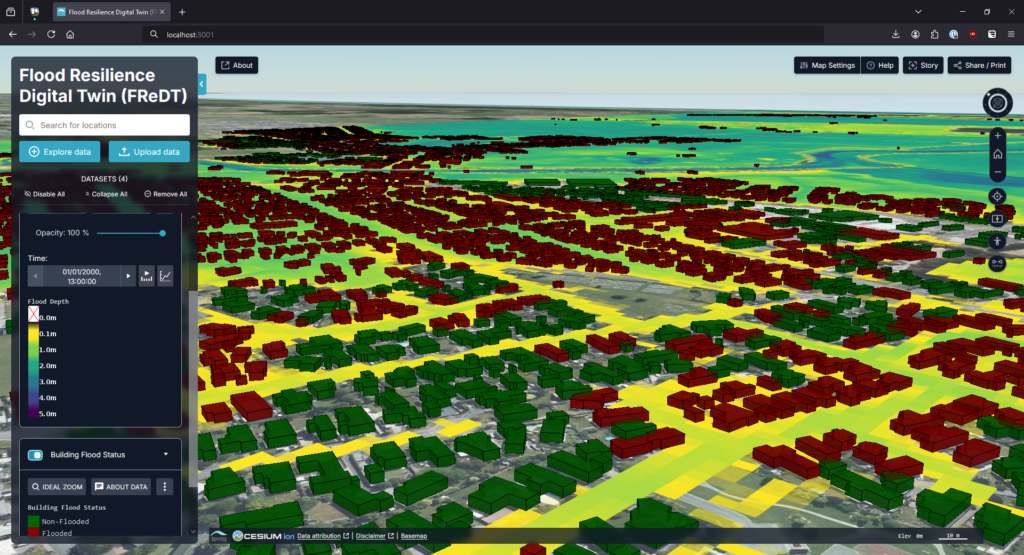
The work for 2025 on creating this digital twin built upon our work on the Flood Resilience Digital Twin prototype and other previous digital twin projects at the GRI. In early 2025, we split the core data ingestion, tasking, and visualisation components of our digital twins into a library and framework that can be more easily reused, the Environmental Digital Data Intelligence Engine (EDDIE).
We migrated the visualisation components of EDDIE from a custom-built Cesium-based library into using the more standardised TerriaJS library. TerriaJS also uses Cesium, but is much more full-featured for digital twin development than working directly with Cesium.
We began the work on expanding our hydrodynamic lower-catchment based Flood Resilience Digital Twin into a full catchment hydrological model, coupled to a hydrodynamic flood model for detailed areas of interest. We have developed preliminary designs for user interface to allow communities to model flood scenarios, and these will be further developed with community engagement in 2026.
2025 Modelling Update:
The dashboard for communities generating their own flood scenarios for decision making or impact assessment is nearly complete. After completion, it will be advanced and modified based on the feedback from the communities.
Necessary data and workflow/pipeline system are being developed and organised. This mainly includes data and models for hydrological and hydrodynamic modelling processes. For hydrological modelling, WRF-Hydro has been replaced by Wflow which is more efficient. For hydrodynamic modelling, two models have been considered – LISFLOOD-FP and BG-Flood.
There will be three meetings with Whirinaki and Mataura communities for introduction and collecting initial feedback. In the next meeting, we aim to let the communities experience the dashboard.
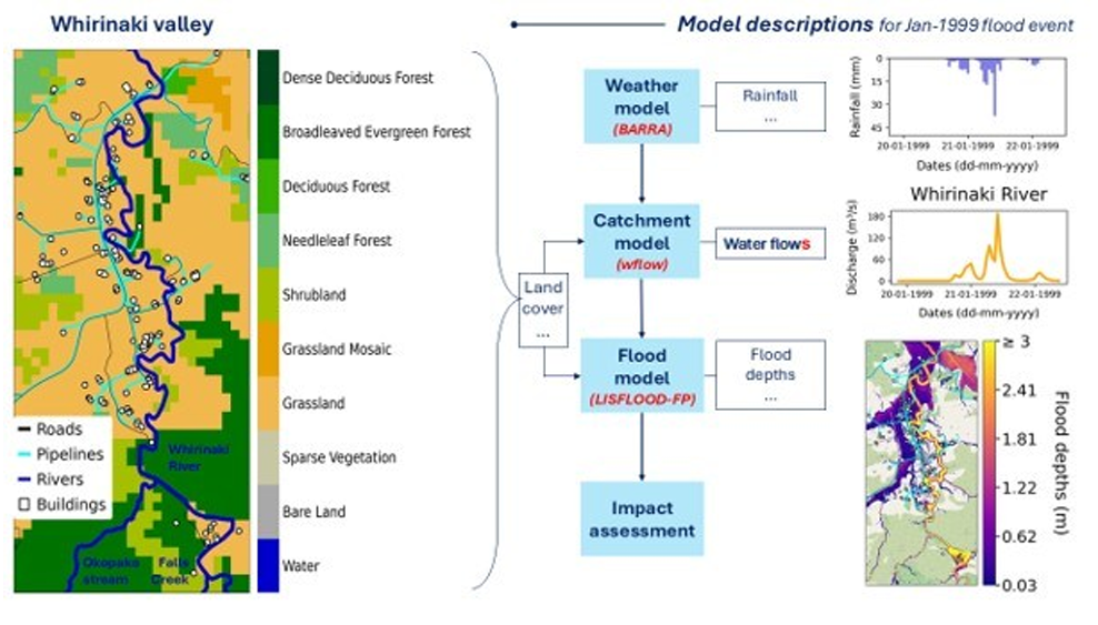
Figure 1. Workflow behind DT dashboard – Whirinaki community
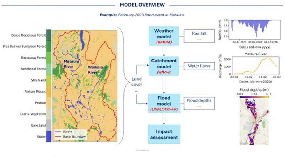
Figure 2. Workflow behind DT dashboard – Mataura community
Workflow behind the visualisation tool. Top figure presents Whirinaki catchment and the bottom one represents the Mataura catchment. These figures describe how the workflow can simulate the flood events. At first, it uses weather data from BARRA e.g. precipitation, temperature, and evaporation. Together with terrain and land cover data included into a Wflow catchment model to generate river/stream flows. Once the flow data is generated, it will be used in LISFLOOD-FP (or BG-Flood) along with terrain data to generate flood model outputs such as flood depths and flooded areas. These results will then be used for impact assessment. The tool will be mainly used to generate multiple nature-based solutions for flood mitigation planning.