
Earth Science in an Age of Change
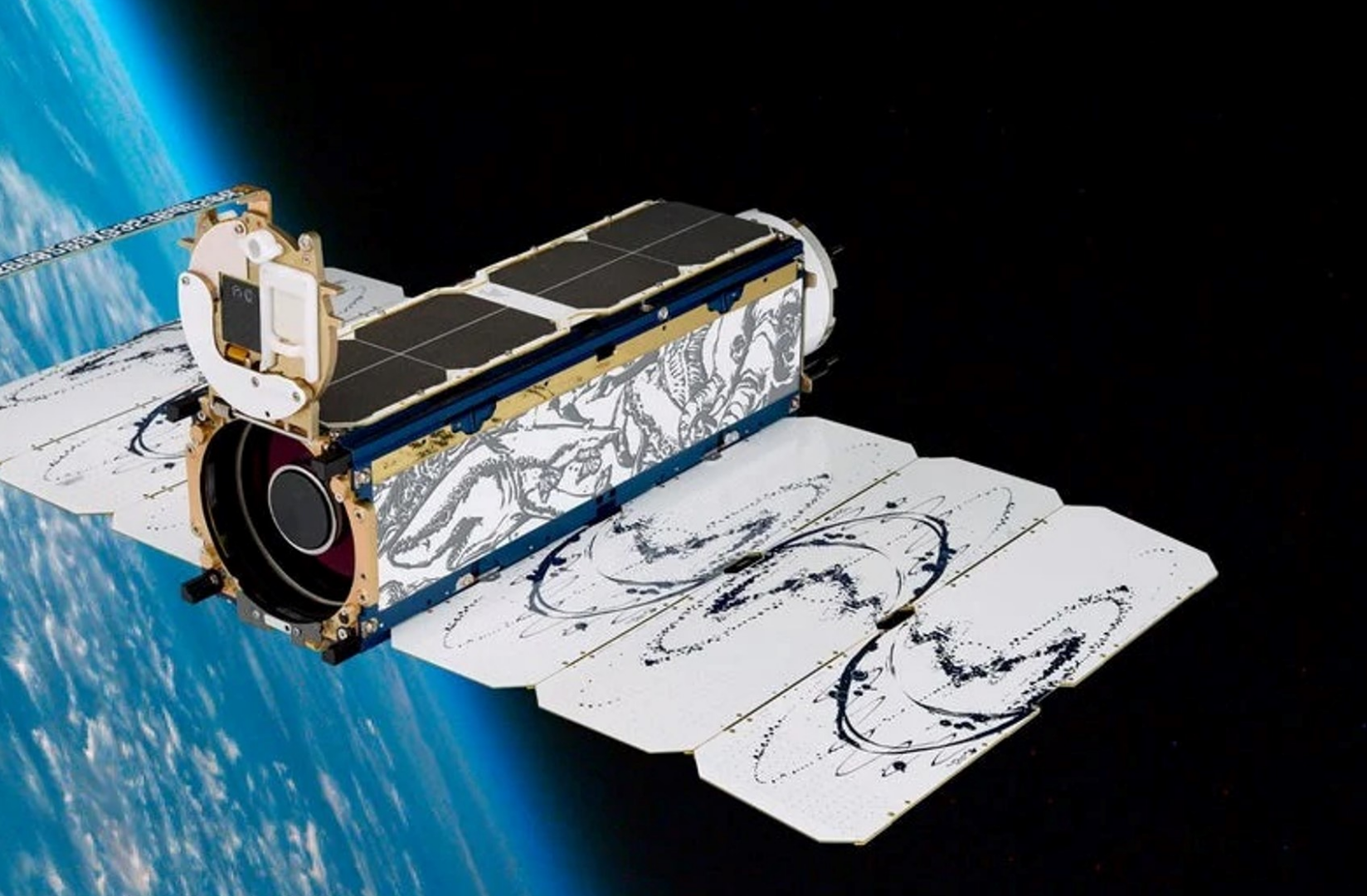
Planet (a public benefit corporation) is imaging the land surface of the Earth on a near-daily basis, with multispectral sensors at ~3.7m per pixel we operate the largest fleet of earth observation satellites in history with a constellation of 19 high-resolution SkySats, capable of 0.5m multispectral imaging. e change, terrestrial an aquatic ecosystems, wildlife biology and agriculture.
Video recording available at:
https://www.youtube.com/watch?v=Dv37CHZct2o&list=PLJymSfBIuEWKYLJbi6LzyiRXKtAQBbcH3&index=7&t=15s
Penguins from Space: Using satellite imagery to monitor emperor penguins in their struggle against a warming Antarctica.
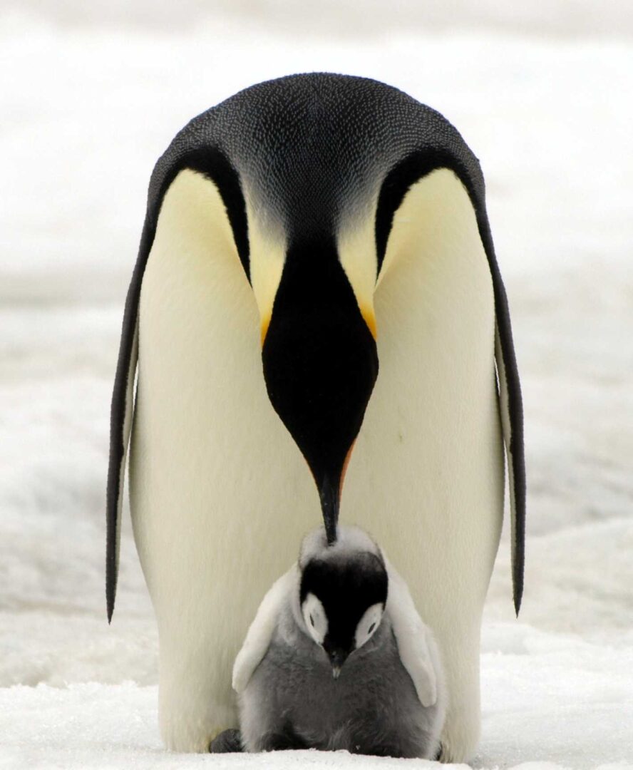
In Antarctica emperor penguins are the species most at risk from climate change. Up until a decade ago our understanding of the species was hindered by the logistical challenges of studying a species which lives in one of the harshest places on earth. But since then advances in our use of satellite imagery has enabled us to find, count and monitor the birds, transforming it from one of the least studied species in Antarctica to one of the best.
Geospatial Research Seminar Series (GRISS) – 30 July 2021
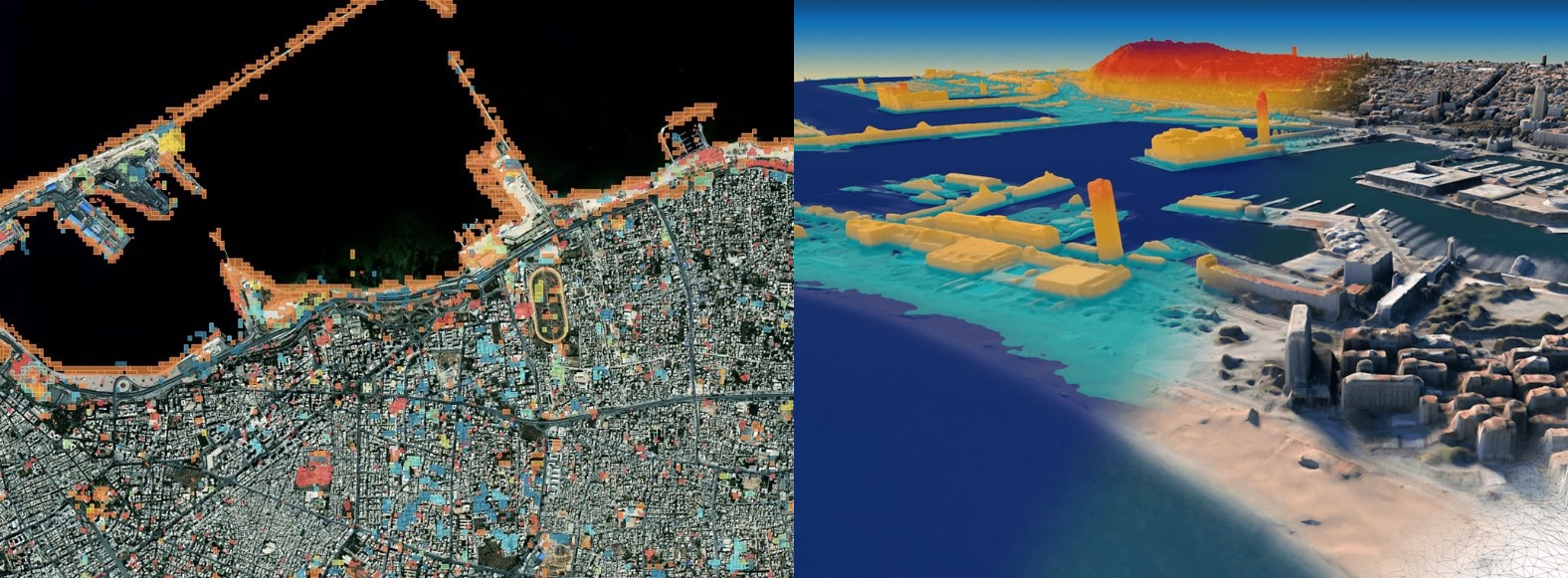
In this time of rapid global change, we need new ways to identify, monitor and understand the impact of change on environments and human dynamics such as economy, health and sociopolitical stability. Maxar Earth Intelligence capabilities help customers map, detect, address and predict change at unprecedented speed and scale. Fueled largely by Maxar’s own constellation of high-resolution imaging satellites and combining multi-source data and applied artificial intelligence, machine learning and rich domain knowledge is able to deliver insight as a service.
Geospatial Research Seminar Series (GRISS) – 5 March 2021

Global Satellite Navigations Systems such as GPS enable positioning information accurate to about 5-10 metres. A Satellite Based Augmentation System (SBAS) will improve the accuracy to less than a metre, and in some devices to 10 centimetres, and provide greater integrity. More precise and accurate positioning increases our productivity, secures our safety and enables innovation. Unlike most regions of the developed world where SBAS is available, Australasia does not currently have access to any reliable free-to-air augmentation services. LINZ and Geoscience Australia are working together to develop a regional SBAS to improve the accuracy of GPS.