
Nationally Consistent Flood Hazard and Risk Information for Aotearoa
This talk will report on results from a 5-year MBIE-funded Endeavour Programme, Mā te Haumaru o te Wai on the development of a semi-automated workflow to consistently model flood hazard and risk over all of Aotearoa for current and future climates, and show results from this work that are being made available on our flood hazard and risk viewing platform to help ensure there is consistent information available.
Radio localisation: Understanding insect behaviour, busting sport cheats and studying climate change.
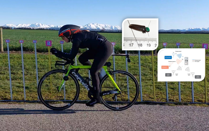
In this seminar, Dr Graeme Woodward will be introducing some of the work at UC’s Wireless Research Centre.
Geospatial Research Seminar Series (GRISS) – 27 November 2020
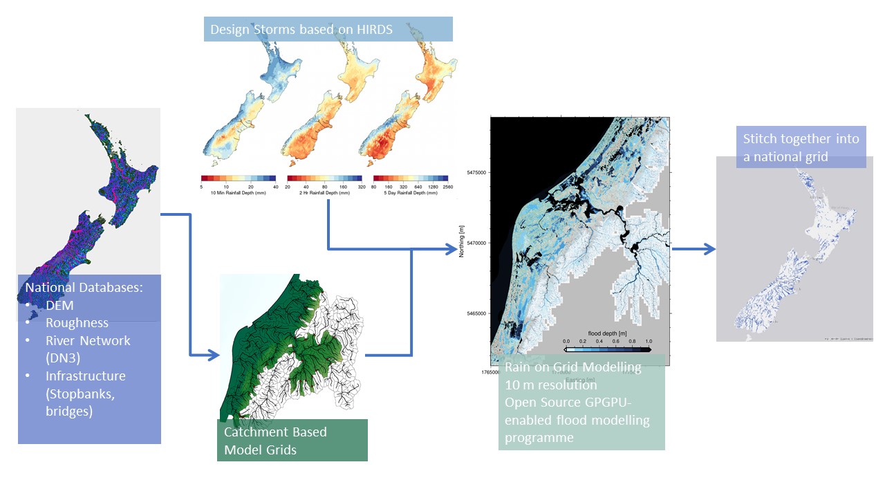
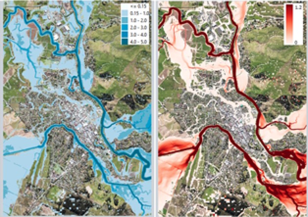
Flooding is Aotearoa/New Zealand’s most frequent hazard and its impact will only increase under climate change through both more intense rainfall events and sea level rise. We are currently going through a massive flooding infrastructure revamp as well as investing in significant urban development. However, we don’t yet have a consistent national understanding of what our flood risk is now – let alone in the future.