
Satellite sensing into agricultural practices: Phase A – ANZ’s Cal/Val campaigns of satellite, airborne and ground GNSS sensing of soil moisture
Research team Shin-Chan Han (University of Newcastle) Matthew Wilson (University of Canterbury) Xander Cai (University of Canterbury) Clevon Ash (University of Canterbury) Martin Nguyen (University of Canterbury) Funding Australia New Zealand Collaborative Space Program Project summary The aim of this project is to demonstrate integration of Global Navigational Satellite System (GNSS) remote sensing measurements of […]
Hydrologically conditioned digital terrain models based on LiDAR for New Zealand
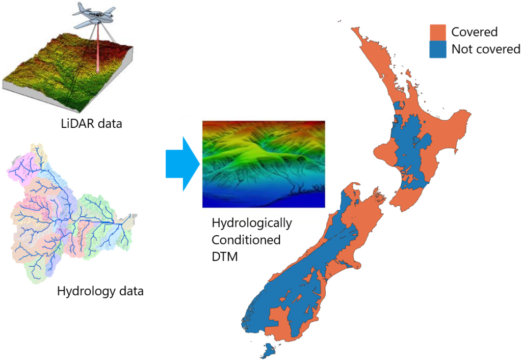
Research team Xander Cai (GRI-UoC) Luke Parkinson (GRI – UoC) Casey Li (BIP – UoC) Rose Pearson (NIWA) Matthew Wilson (GRI – UoC) Funding Internal Duration 2023 – 2025 Project summary Elevation is the fundamental data in geoscience research and application. The output precision of many GRI projects relies on the accuracy of digital elevation […]
Using machine learning to estimate soil moisture from GNSS-Reflectometry
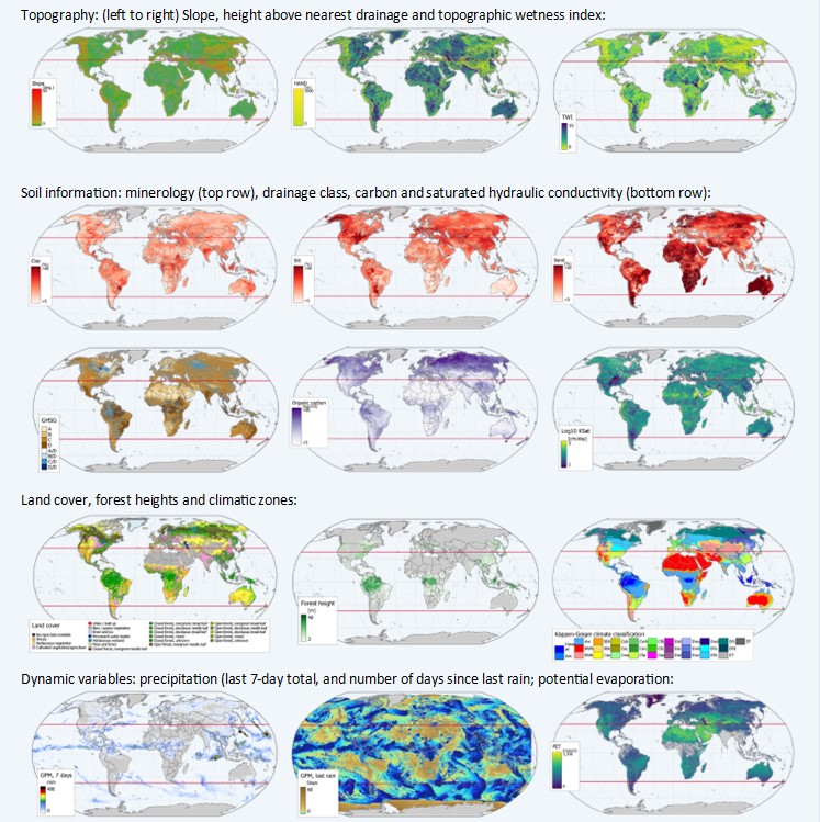
PhD Student Matthew Wilson (GRI– UoC) Rajasweta Datta (GRI-UoC) Sharmila Savarimuthu (GRI-UoC) Funding MBIE Catalyst programme. Project summary Soil moisture is an important controlling factor in vegetation health and is a significant component of catchment hydrology. Regular soil moisture monitoring across agricultural areas helps to quantify irrigation and check for signs of crop distress, for […]
Rongowai:
Partnering to fly the Next-generation of Global Navigation Satellite System Receivers for Advancing Earth Observation
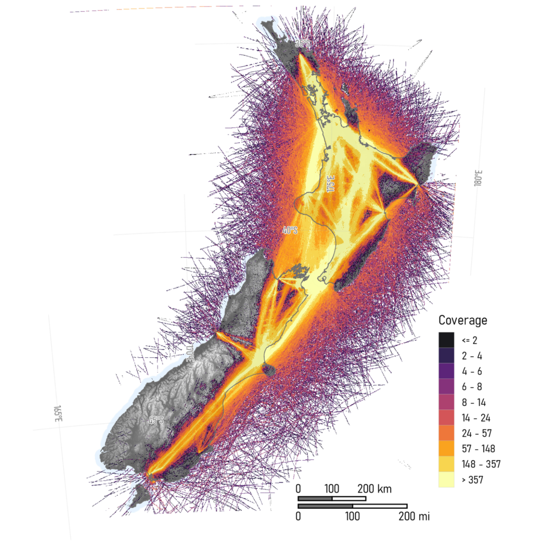
Project Team: Prof. Delwyn Moller (Project lead, University of Auckland) Prof. Matthew Wilson (GRI) Wider team: Xiaoyou Lin, Mike Laverick and Chris Seal (University of Auckland), Wayne Thomas (Air New Zealand), Chris Ruf and Steven Musko (University of Michigan), Andrew O’Brien (Ohio State University), Scott Gleason (UCAR), and others. Funding MBIE Catalyst fund and NASA […]
Biological Heritage Challenge: Eco-Index Programme: Sub project: The Ecosystem Detector
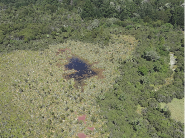
Research teamDr Kiri Joy Wallace (University of Waikato)Dr John Reid (J D Reid LTD)Matthew Wilson (University of Canterbury)Ngāti Pikiao (Tainu and Ngai Tahu Research Centre, University of Canterbury)Nathaniel Calhoun (Code Innovation)Kevan Cote (Moose Engineering & Design)Karen Denyer (Papawera Consulting Ltd)Saif Khan (University of Canterbury) Length of Project: 2022-2024 FundingNew Zealand National Science Challenge Eco-index Research […]
Modelling large-scale predator control measures: Cape-to-City project
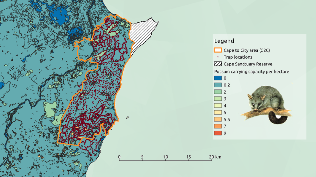
New Zealand has an excellent record of conserving its native flora and fauna through pest control measures, especially in large uninhabited areas. Meanwhile large tracts of land owned by private individuals remain relatively unprotected. When it comes to land management decisions such as pest control actions, careful negotiations are required with a wide range of stakeholders with differing views – from cat-loves to rabbit-haters – so that agreements can be reached. The aim of this research project led by Audrey Lustig, Mike Plank and Alex James is to develop a planning tool for predicting the abundance and the likely persistence of New Zealand top mammalian predators in the light of potential changes in management effort across human-dominated landscape. We use the Cape-to-City (C2C) footprint covering 26,000 ha of agricultural land in Hawke’s Ba as a case study.