
PhD Student
David Pedley (SoF- GRI)
Supervisors
Dr Justin Morgenroth (UoC)
Dr Grant Pearse (Flinders University)
Funding
GRI Scholarship and UC Doctoral Scholarship
Project summary
Urban trees provide a multitude of environmental and amenity benefits for city occupants yet face ongoing risk of removal due to urban pressures and the preferences of private landowners. Understanding the patterns and drivers of canopy loss on private land is critical for the effective management of urban forests. Although city-scale assessments of urban forest canopy cover are relatively common, the accurate identification of canopy loss at the property scale remains challenging. Evaluating change at the property scale is of particular importance given the localised benefits of urban trees and the scale at which tree removal decisions are made.
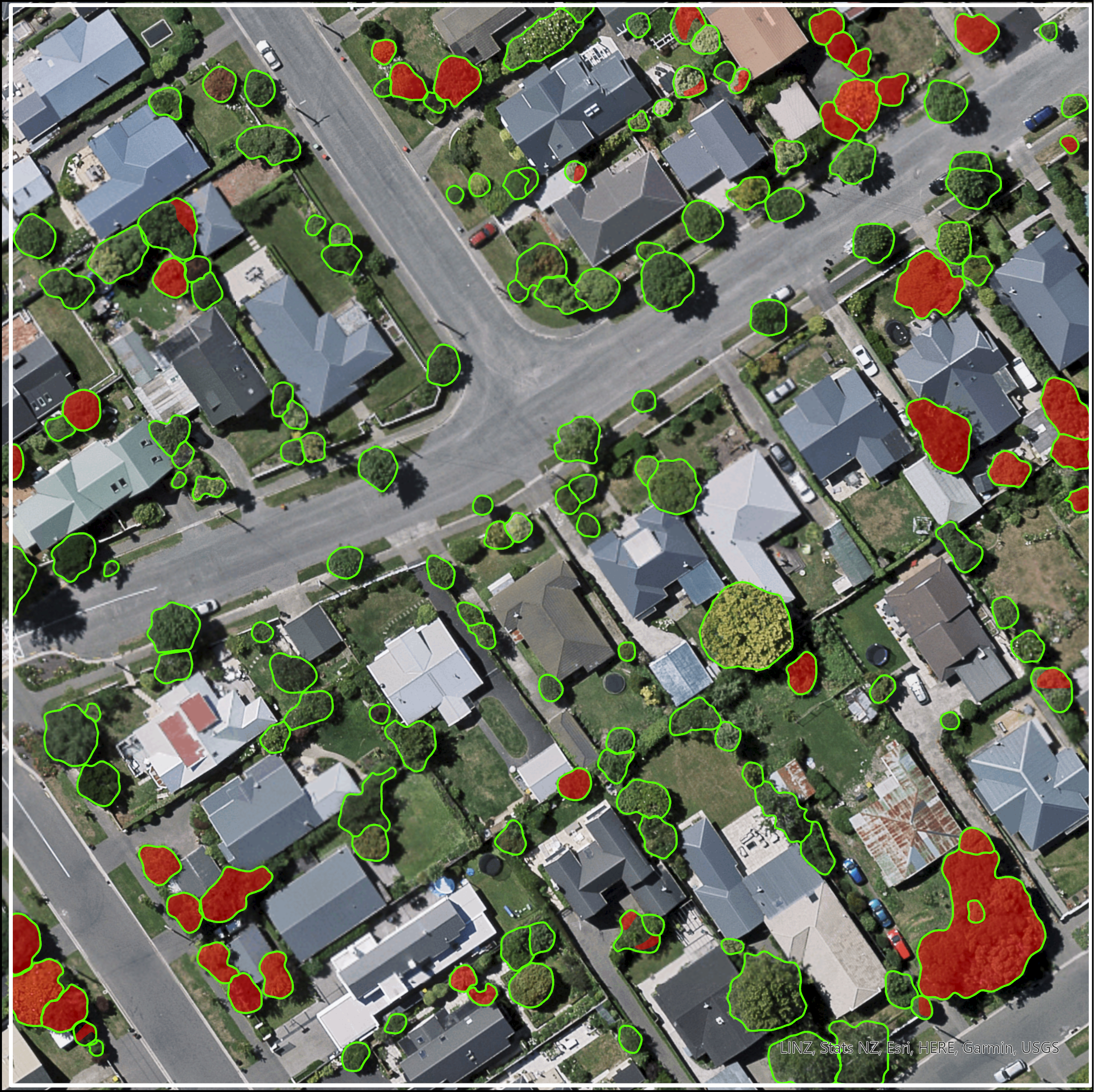
The first objective of this study was to detect and quantify the city-wide loss of urban tree canopy (UTC) at the scale of individual properties using publicly available remote sensing data. The study area is Christchurch, New Zealand, with the study focussed on UTC loss that occurred between 2016 and 2021. A common method for mapping UTC is object-based image analysis, where aerial or satellite images are segmented into discrete objects based on their spectral and textural characteristics and spatial arrangement. To improve the accuracy of the output, the study utilises a convolutional neural network deep learning model, which has achieved state-of-the-art performance for UTC mapping that exceeds the accuracy of traditional methods.
The model architecture utilised in this study was DeepLabV3+ with a ResNet101 backbone. The model was pretrained on a large quantity of existing tree canopy data from a previous mapping exercise, before being fine-tuned on hand-annotated training samples created from high resolution RGB aerial imagery for 2016. This method of pretraining a deep learning model using noisy or lower quality training data is a valuable technique to improve the accuracy of model predictions without the need for large amounts of hand-annotated training data. The output of this model was a binary raster of tree canopy, which was then segmented into individual tree polygons using a second deep learning model, being the open-source Segment Anything Model by Meta. The resulting UTC map was compared to height loss polygons (derived from multi-temporal LiDAR) to identify polygons of UTC loss that occurred between 2016 and 2021. These polygons could then be allocated to specific property titles to quantify the extent of UTC loss for each property within the study area.
The property-scale identification of tree loss creates the opportunity for detailed evaluation of the drivers of urban tree loss on private properties to enable better management of existing urban forests. This is the focus of the second research stage, which will investigate the potential conflict between residential housing intensification and UTC loss during the study period. Although the provision of intensified housing can provide many benefits and efficiencies, it is important to understand whether housing intensification may be inadvertently resulting in the loss of existing urban trees. The final stages of the research project will employ a variety of methods to assess the extent to which past tree loss has been offset by new planting and evaluate whether regulation is an effective approach for protecting urban trees.

