
Project leaders
Matthew Wilson (GRI)
Robert Deakin (LINZ)
David McMeekin (Curtin University)
Project team
Jeremy Siao Him Fa (Curtin)
Kasey Oomen (LINZ)
Ivana Ivánová (Curtin)
Duration
2017
Funding
CRCSI and LINZ
Aim
In this project, we aimed to address these issues through the specification of federated spatial data infrastructures which may then form a key part of an SKI, and the development of prototype APIs which leverage these data into relevant information.
Key objectives included:
- to engage with flood risk management practitioners (end users); to identify current practice and needs for data federation;
- to identify data sources and types which are relevant for flood risk management;
- to review existing spatial data infrastructure technologies and to assess their capabilities for real-time data federation.
Summary
A hazard situation can change quickly during an event, near real-time integration of dynamic datasets (e.g. rainfall or river flow observations) could be used to enable risk managers to obtain up-to-the-minute information (e.g. updated risk assessments), to aid their decision making. In the spatial domain, automated real-time integration and analysis of data is most effectively achieved at a local scale; however, currently used Spatial Data Infrastructures (SDI) are not designed with automation in mind, but rather to minimise interoperability issues.
In this project, we propose that the current SDIs would be improved, shifting their capabilities towards those of a Spatial Knowledge Infrastructure (SKI), which would allow data to be integrated and analyzed in real-time, enabling experts to refocus on the repercussion of hazards and the risks associated with them.
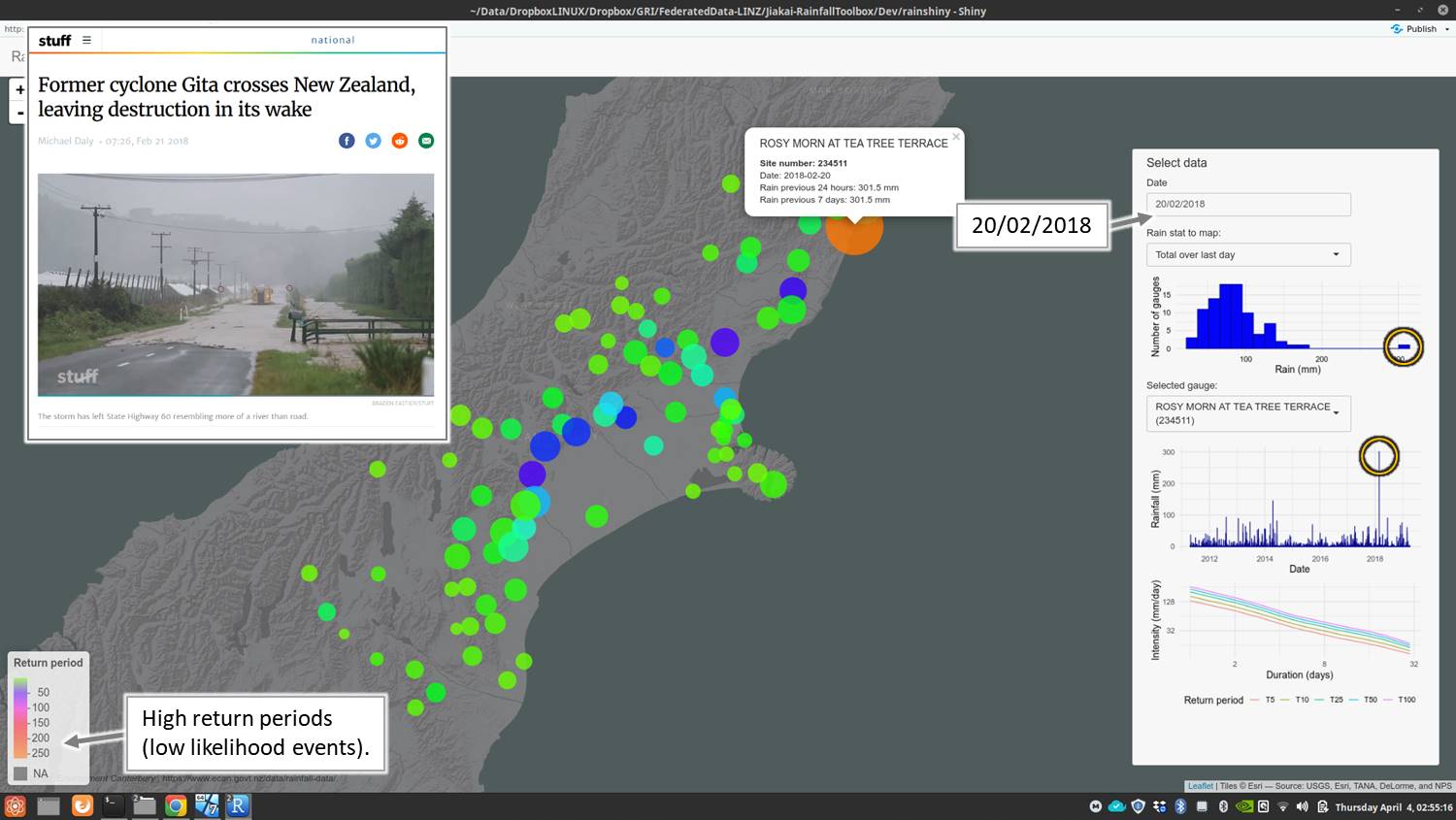
This project is a collaborative work developed to aid with the advancements in flood risk mitigation, where is a clear need to increase data interoperability and accessibility, to improved mapping and assessment of flood hazard. APIs were developed to illustrate the rapid production of information to flood managers, such as determination of the significance of measured or forecast rainfall.
Key results
A national flood model system was identified as a main priority tool to be developed. Major expectations regarding this tool were related to consistency and provision of live flood information as well as to be open source, so that experts can input their own datasets, and extract information needed. Other features of interest were: model flexibility, integration with existing risk assessment tools such as RiskScape, impact evaluation, enable the development of site specific models for infrastructure design activities, and allowing near real-time scenario modelling.
The priorities for improved flood-risk modelling and the issues identified with the current system, strongly support the implementation of a SKI. Approaches to improve them can be tackled by taking an SKI-based approach. The participants saw benefits with the concept of an SKI for better flood-risk management. However, some concerns were identified. To overcome these difficulties, small-scale or partial demonstrators are necessary as a first-step to provide tangible, beneficial outputs and confidence that a larger SKI implementation would be worth investing. To fully implement a SKI, the participation of its stakeholders is crucial. This project has taken a first step in this regard, by engaging with flood modellers and managers to understand their needs and interests. Such users provide essential feedback to support system design and adoption.

