Date
2022
Authors
Matthew Wilson, Greg Preston, Casey Li, Xander Cai, Luke Parkinson, Rose Pearson, Rob Deakin, Emily Lane
Abstract
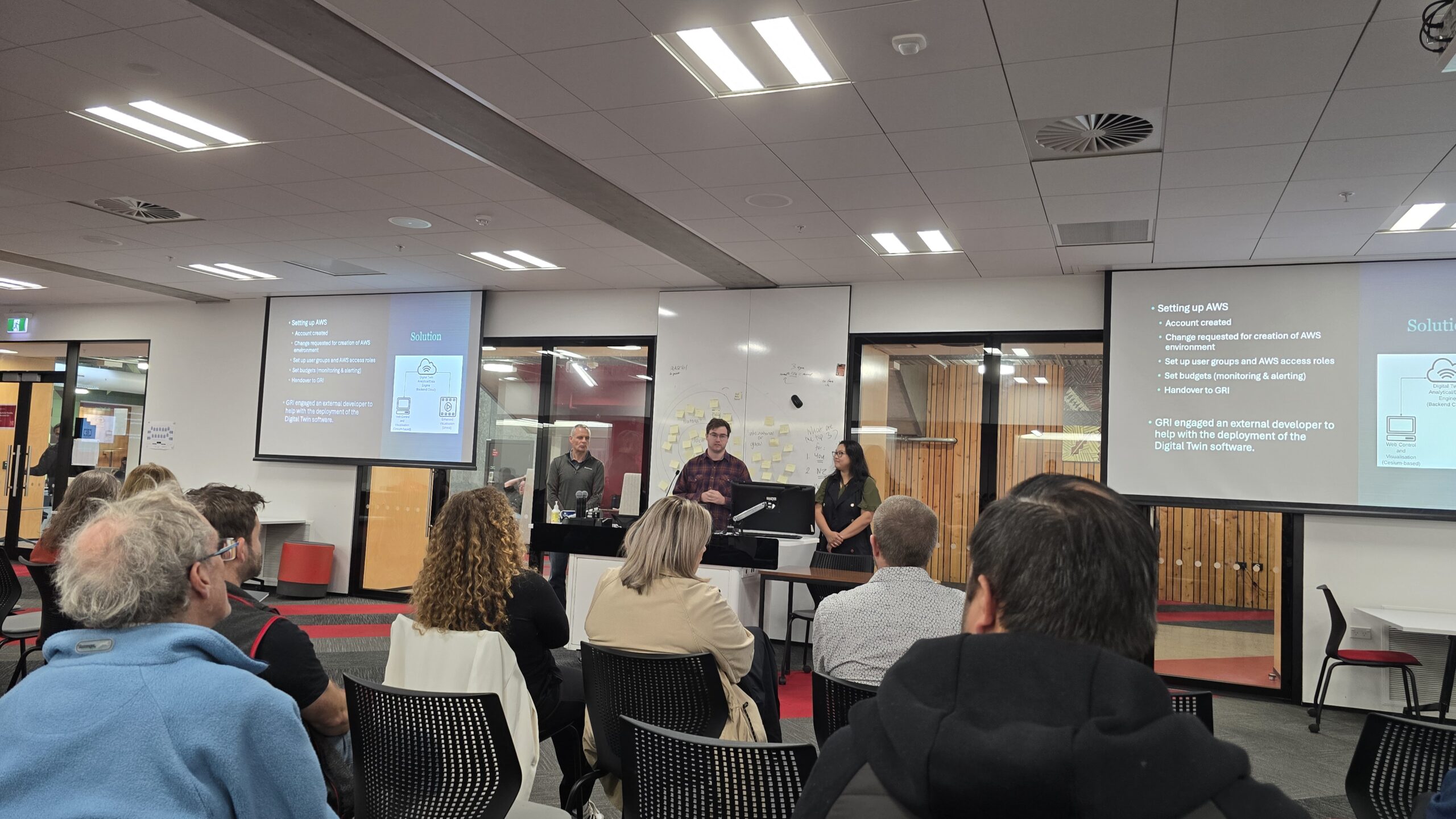
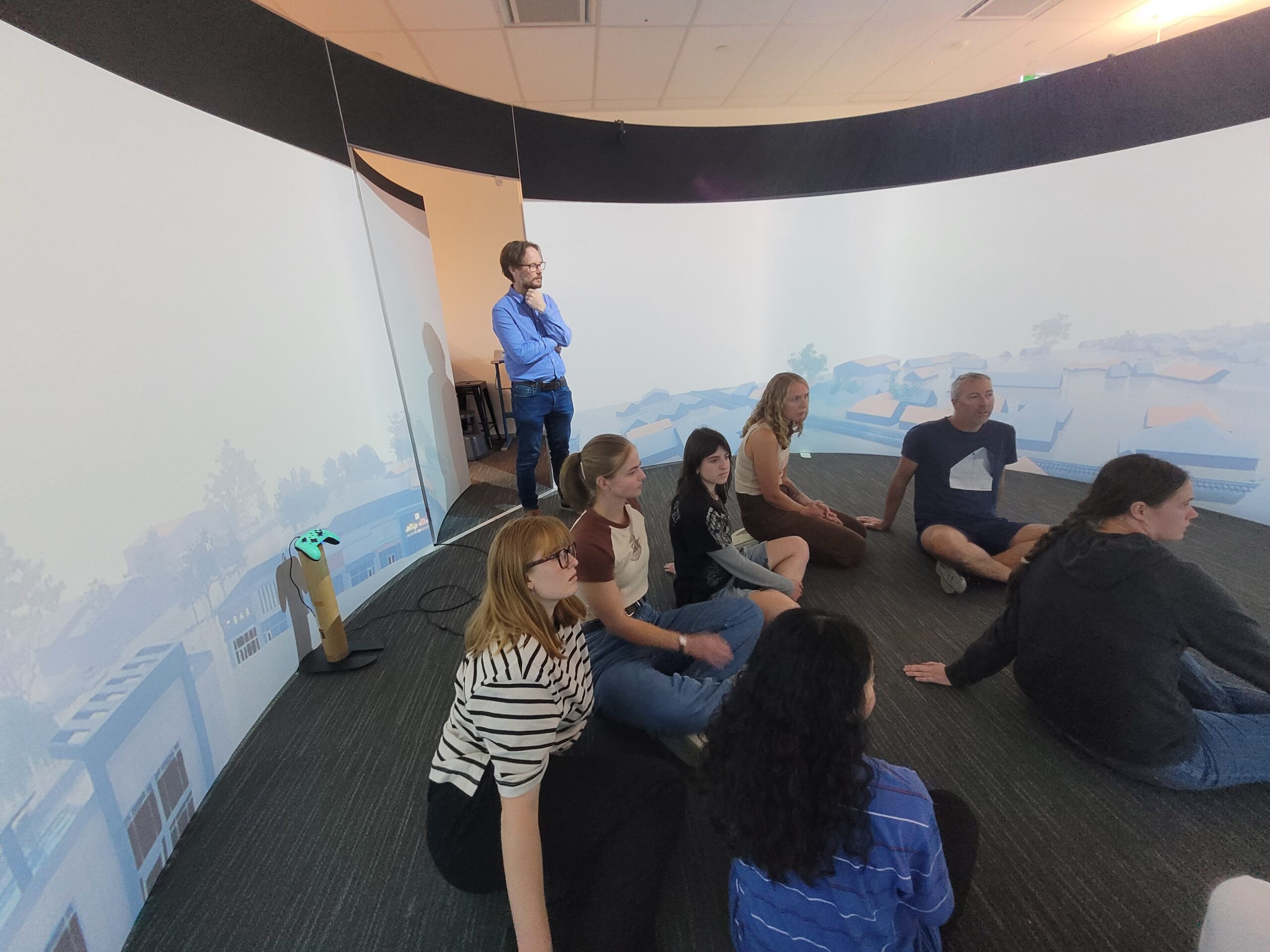
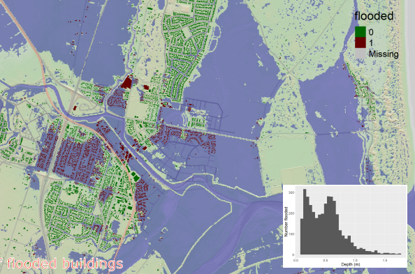
Flood inundation is a frequent, widespread, and impactful hazard, which regularly causes damage to housing and infrastructure along with disruption to communities and businesses. Further, flood risk is expected to increase in future, due to increased storminess caused by climate change, and rapid urbanisation. To manage this risk, it is essential that we become more efficient at flood risk management. We need to improve land use planning to take account of multiple scenarios for potential flood impact or mitigation. However, the computational modelling and scenario assessment required for such flood risk management and mitigation requires substantial amounts of spatial data related to infrastructure and the environment, making it challenging and expensive. This is a particular problem for smaller regions or communities where the costs of such analysis may be prohibitive. Environmental digital twins can solve this challenge by enabling automated data capture and rapid processing of large volumes of disparate geospatial data. When combined with automated data analytics, this can break down barriers which exist for decision making due to the significant expertise and resources required to process, join, and analyse data. In this presentation, we share our prototype Flood Resilience Digital Twin (FReD). This open-source system automates the ingestion and processing of the varied data needed for flood risk assessment, runs a computational flood model to assess multiple scenarios, then ingests and analyses the results enabling potential flood impacts to be assessed. This is integrated with a web based interface and 3D visualisation tool, which provides a powerful front-end to access the digital twin. Once complete, the system will enable decision makers to obtain flood impact assessments on demand, for existing or new flood hazard scenarios, during events or as part of planning scenarios.
Click to view or download the PDF of the poster.