The health research projects presented here are developed by Te Taiwhenua o te Hauora | GeoHealth Laboratory. The lab was created in 2004, in a partnership between the Ministry of Health and the University of Canterbury. Although, our partnership ended in 2021, the lab continues to be active to date.
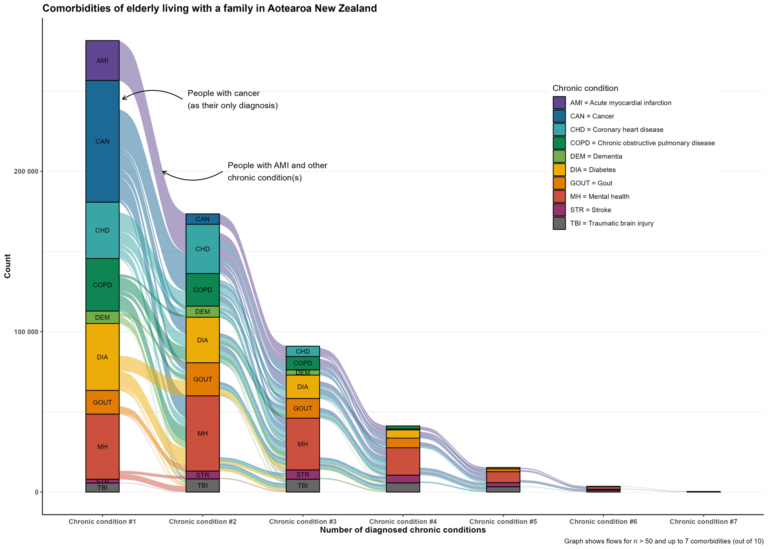
The GeoHealth Laboratory undertakes applied research in the areas of health geography, spatial epidemiology and Geographical Information Systems. In particular, the research developed by the GeoHealth Laboratory focuses upon how the local and national contexts shape health outcomes and health inequalities. Some of our projects relate to the analysis of how characteristics of local environments, such as the effect of access (e.g. access to parks, food stores and healthcare provision), influence health outcomes and health-related behaviours.